The Age of The World’s Borders Map
The Map created by PisseGuri82 shows the date of origin for every international border
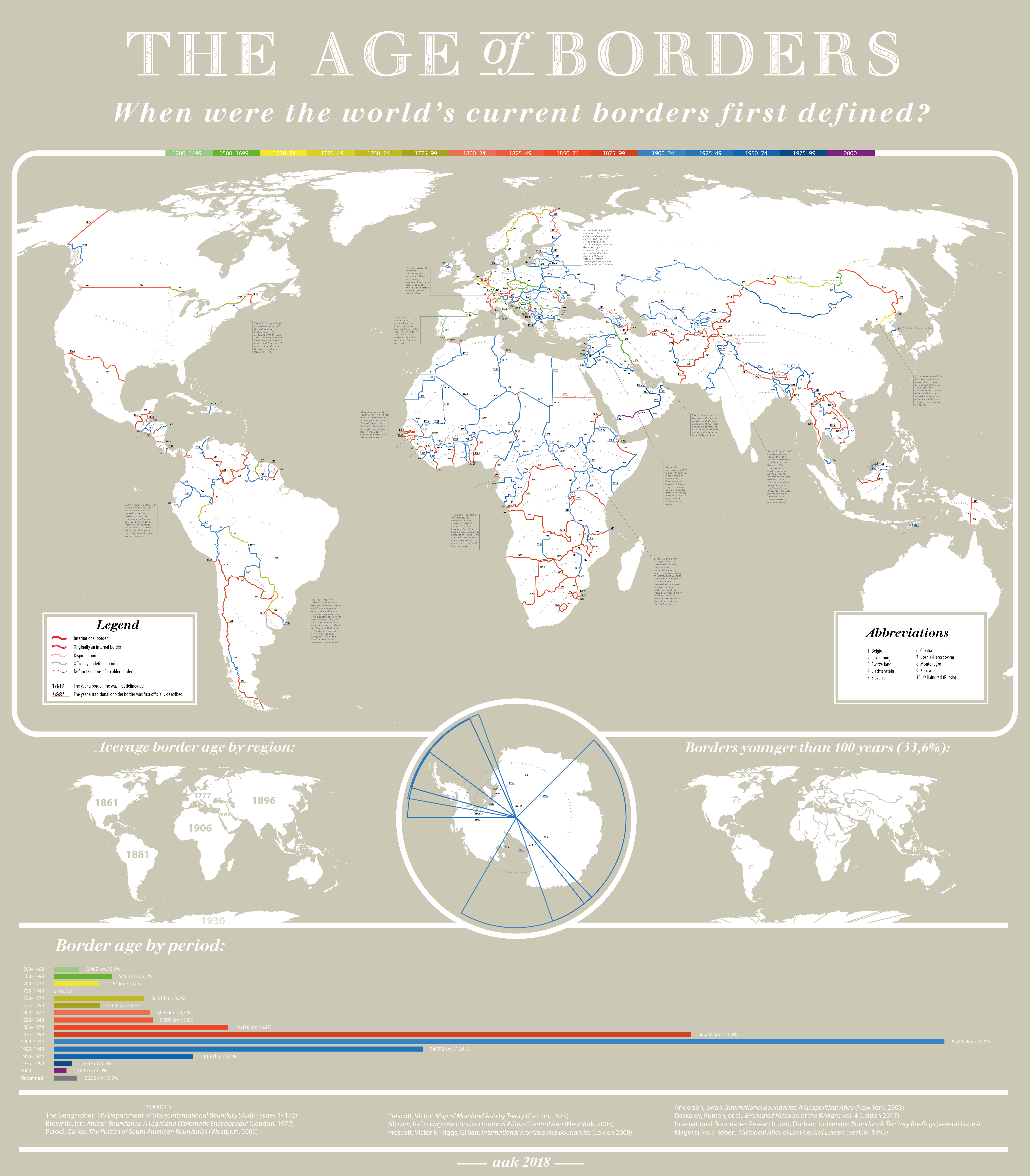
Click on map for full resution
The oldest border is Andorra’s border (1278)
Actually (is not on map) from 1147 until 1896 there was a microstate, Couto Misto (Portuguese), Coto Mixto (Spanish) on the border between Portugal and Galicia, Spain with 27 km2.
Portugal's border (1297)
The youngest border is a segment between South Sudan and Sudan ( 2009)