Climbing Aconcagua, Argentina, the Summit Attempt
“We are going, get dressed !!!”, the guide was yelling at the top of his lungs, barely audible above the noise of the howling wind, only about one metre from my ears, ”Let’s go !!!”. He left and I quickly zipped the tent closed. We were looking at each other, puzzled, are we going up or down the mountain????
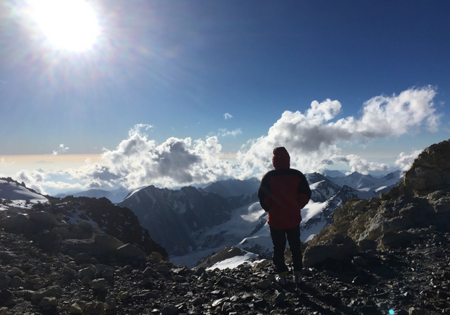
Views from the mountain, own photo
A quick recap from my previous posts: post two and post one: we were climbing Aconcagua in Argentina, the highest mountain in the Southern hemisphere, with an international bunch of climbers. We started off in Mendoza, famous for its wine, and spent quite some time in a tented camp in Plaza de Mulas, base camp for most climbers attempting to climb Aconcagua. We had climbed Mount Bonete, at 5000 metres an ideal acclimatisation climb, and had done our food and tent drops at the higher camps, for use during our summit attempt.
We had set off from Plaza de Mulas, base camp for Aconcagua, at 4,370 metres of altitude, and reached the higher camps without any major issues. The last medical check at base camp revealed that we were coping well with the altitude. Some members of our team had received some bad news, they were showing the first signs of altitude sickness. They were told to go down the mountain, as soon as possible, which is often the only solution to cure altitude sickness. Our departure for Camp 1 from base camp was therefore a little sad, as we had to say goodbye to some members of our team.
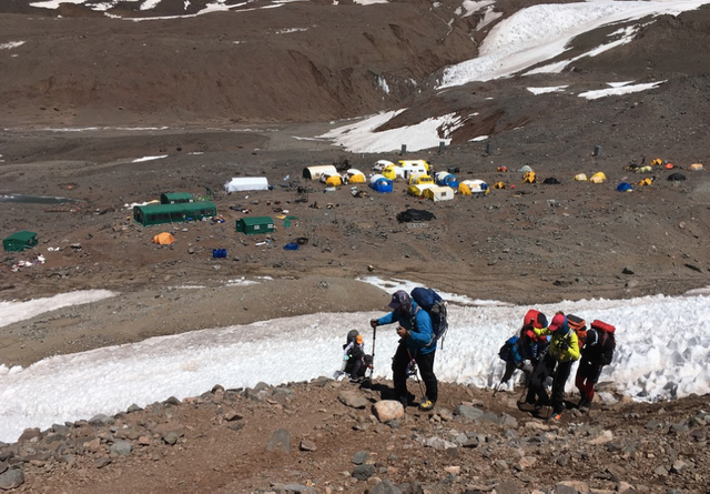
going up from base camp, own photo
Food up the higher camps is by default a lot less interesting than in base camp, as everything has to be hauled up by human power and therefore has to be as light as possible. In base camp mules are used to carry up loads, and sometimes even the helicopter is used. The quality of the food that the guides manage to prepare in base camp is amazing; they are even baking pizzas as a special treat. Up in the higher camps all the water originates from snow and ice, and a lot of time is spent melting the ice and snow to make sure there is enough water for everybody. We had also spent New Year’s Eve in base camp and they had managed to pull off quite a party.
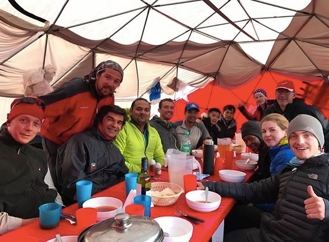
Dinnertime in base camp, own photo
From Camp 1 at 5,000 meters, we went onward to Camp 2 at 5,570 meters, and up to Camp 3; we slept one night in each of these camps. The route is not technical at all, just very steep with a lot of loose rocks. Higher up the mountain the amount of snow increases and it’s there where the crampons are attached to your mountain boots, to make sure you don’t slide down the mountain. We were still coping very well with the altitude, I had a little moment in Camp 3 where I almost had to vomit, but I recovered quickly and we managed to keep on eating and drinking. Especially drinking is very important, as dehydration is extremely dangerous at higher altitudes.
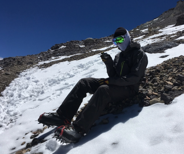
Using crampons, own photo
So there we were in a small tent at 6,000 metres altitude and had not slept the whole night. The wind was howling and half of the night I had been sitting against the tent poles to make sure the tent wouldn’t be flattened; the power of the wind was immense. The noise of the tent flapping around was incredible and lasted the whole night, and we could barely hear each other, even if speaking loudly. Our guide had passed by our tent at 3:00 am, which was supposed to be our time to wake up for the summit attempt. He had informed us that we were not going up, the wind was simply far too strong. So now, after waiting an additional three hours, we were getting dressed, but still unsure whether it would be to attack the summit or to admit defeat and go down.
We were trying to dress quickly while the wind was still howling. Getting dressed at higher altitudes takes forever, somehow your brain coordination is slowing down and getting a boot on your feet is a major task. When I finally managed to unzip the tent and have a look outside, I saw four guys almost ready with our guide. I only now understood we were going to try to go up and not down. Ouch, I thought, that’s is late. The usual time to go up is at 4 am, to give you plenty of time to get back when it is still light. By now it was almost 7 am.
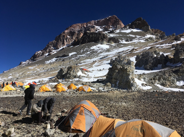
Camp 3, own photo
We joined the small summit group, half of the group had decided not to do the summit attempt. It appeared that one of our guides had altitude sickness and he was also not going up. For all the days that we were climbing up our main guide had told us the mantra of going extremely slowly, and had told us to pace ourselves. Now however, he was flying up the mountain, perhaps trying to make up time because of our late departure. After a while, my partner decided to go back to the camp while we could still see it, as the pace was just too quick.
I tried to get my legs going but somehow my body was not willing to comply with what my brain told it to do. The wind, although a little less, was still howling and the snow was flying around. Slowly, slowly I lost ground on the four guys ahead… Then I gave in, and turned around. Considering everything, our late departure, the howling wind, the fact that my legs were not working as before, I finally made the decision to turn around and I also went back to the camp.
We broke up camp and went down the mountain back to base camp. Unfortunately, as we had run out of time, another summit attempt was not possible, but we vowed to come back to Aconcagua to stand on top of South America. We later heard that only three members of our team managed to summit. When they came down, they were battling extremely strong winds; their tents at high camp had been ripped apart and they had to resort to spending the night in an emergency shelter, before coming down back to base camp.
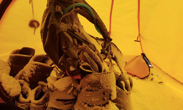
Cold tent, own photo
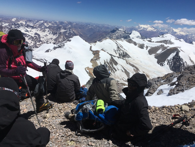
views from the mountain, own photo
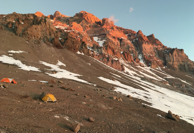
below some facts about Aconcagua:
Aconcagua – some facts:
• 6,961 metres high (22,837 ft)
• Argentina
• Highest mountain outside Asia
• Highest point in the Southern Hemisphere
• Part of the Andes mountain range
• 15 kilometres from the border with Chile
• Aconcagua is one of the Seven Summits
• ‘Aconcagua’ either means ‘Sentinel of Stone’, ‘White Sentinel’, there are some other meanings around as well
Climbing routes on Aconcagua
• The North route is the normal route
• The North route does not require any technical climbing
• The camp sites on the northern route that we passed through were:
o Penitentes 2,740 metres
o Confluencia 3,380 metres
o Plaza Francia
o Plaza de Mulas 4,370 m, base camp
o Plaza Canada, 5,050 metres
o Nido de Cóndores, 5,570 metres
o Plaza Colera, 6,000 metres
• Our estimate is that around 30 % of climbers succeed in reaching the top
Congratulations @ultrabiker! You have completed the following achievement on Steemit and have been rewarded with new badge(s) :
Click on the badge to view your Board of Honor.
If you no longer want to receive notifications, reply to this comment with the word
STOPTo support your work, I also upvoted your post!
Heya, just swinging by to let you know you're being featured in our Daily Travel Digest!
Great, thanks for letting me know!
To listen to the audio version of this article click on the play image.

Brought to you by @tts. If you find it useful please consider upvoting this reply.
Too bad you did not reach the summit, but respect you made the wise decision to turn around when it was still possible. Hope you’ll succeed on the next attempt :)
Hi @steef-05, yes for sure, we are headed there again this December, hopefully we’ll succeed this time!
Good luck and stay safe!
Congratulations! Your high quality travel content caught our attention and earned you a reward, in form of an upvote and resteem. Your work really stands out. Your article now has a chance to get curated and featured under the appropriate daily topic of our Travelfeed blog. Thank you for using #travelfeed
Learn more about our travel project on Steemit by clicking on the banner above and join our community on Discord
Thank you @travelfeed, really appreciated!
Congratulations, Your Post Has Been Added To The Steemit Worldmap!
Author link: http://steemitworldmap.com?author=ultrabiker
Post link: http://steemitworldmap.com?post=climbing-aconcagua-argentina-the-summit-attempt
Want to have your post on the map too?
Wow! What a trip! I think it doesn't even matter that you didn't reach the top as you took the right decision to return back to the base camp and stay safe.
The pictures are amazing! What was the temperature there? It looks really cold!
Thank you @delishtreats for stopping by and happy you liked my post. Above 5,000 it is around -20C on a good day, but the windchill makes it feel a lot colder if there is a lot of wind....
Amazing adventure! Hope you liked my country as much as I do.
You could still make it in other mountain, we have many with great sights.
Where are you going now?
Hello @hijosdelhombre and thanks for stopping by. We really enjoyed Argentina, and we are coming back in December to try again!
Congratulations @ultrabiker! You have completed the following achievement on Steemit and have been rewarded with new badge(s) :
Click on the badge to view your Board of Honor.
If you no longer want to receive notifications, reply to this comment with the word
STOPCongratulations @ultrabiker! You have completed the following achievement on Steemit and have been rewarded with new badge(s) :
Click on the badge to view your Board of Honor.
If you no longer want to receive notifications, reply to this comment with the word
STOP