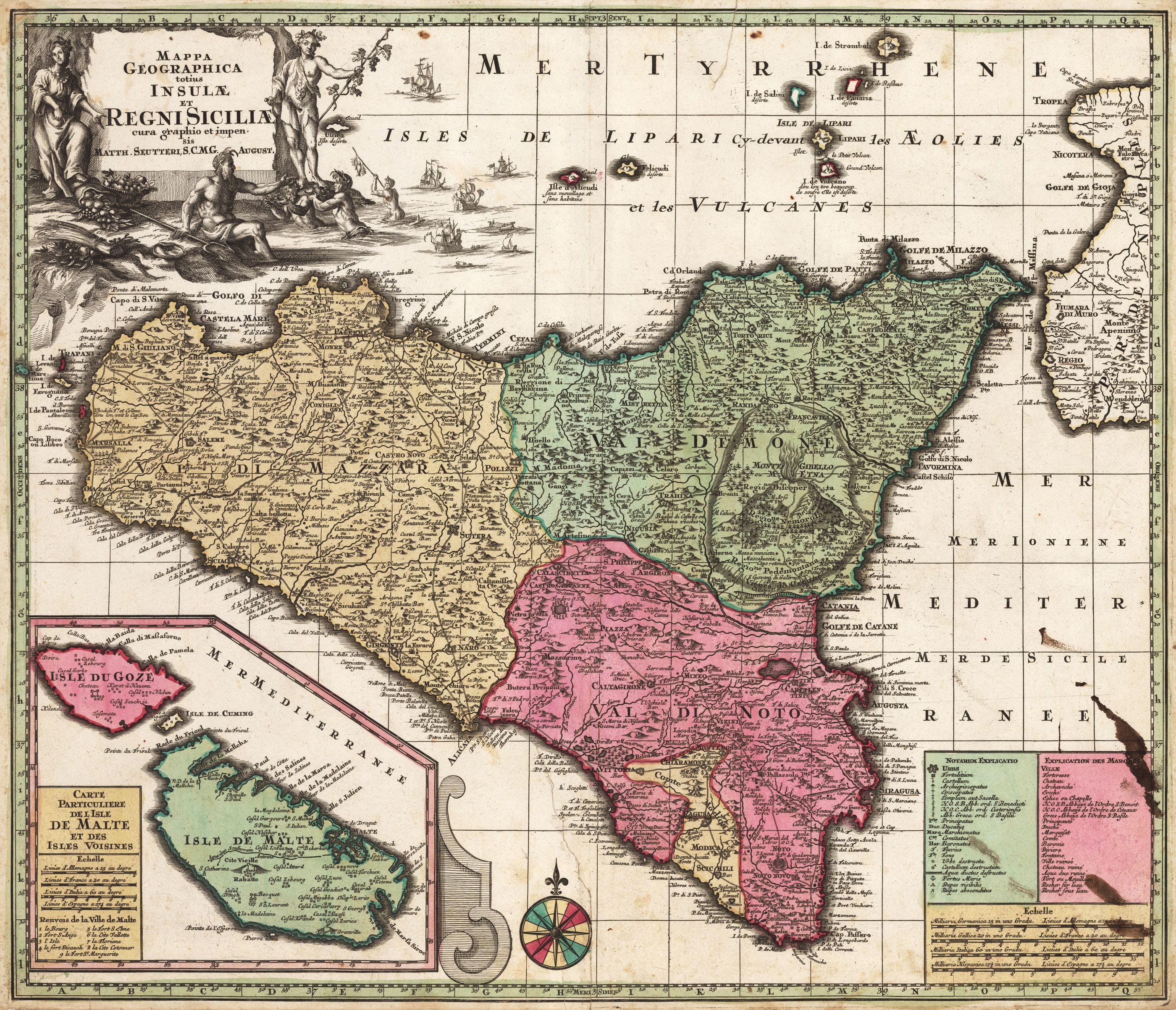
18th Century Map of Sicily: Includes the location of a healing sulfur spring, an erupting Mt Etna, and gods of Greek and Roman mythology

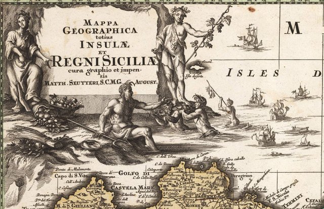
Mappa Geographica totius Insulae et Regni Siciliae cura graphio et impen sis Matth. Seutteri, S.C.M.G. August
By: Matthias Seutter
Date: 1730 (circa) Augsburg
Size: 19.75 x 22.75 inches (50.2 cm x 57.8 cm)
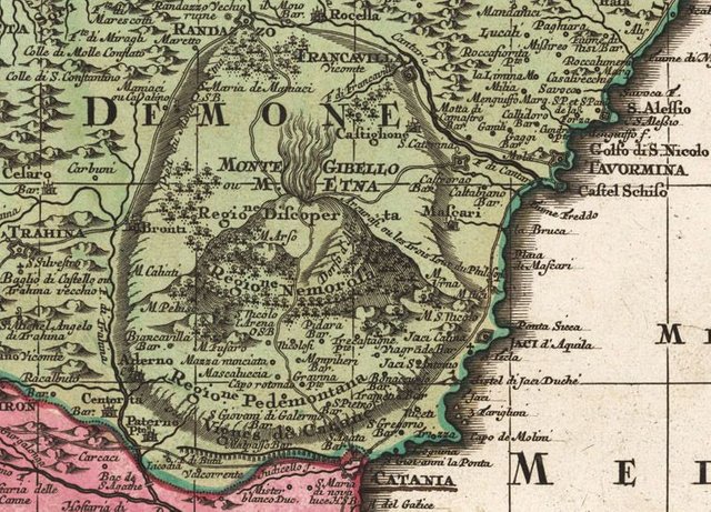
This bold map of Sicily by Matthias Seutter is one a series completed by him featuring Italy and the principal islands which are in close proximity to the mainland. Seutter expresses obvious interest in the volcanic activity in these maps, and this one is no exception. Etna is depicted as if ready to erupt, while other volcanoes in the region are also included.

Sicily is rendered in high detail, with all topographical features boldly delineated. Natural features are included, as are all inhabited regions. A number of forested areas are included as are routes between cities, most of which are based on roads from antiquity, they circle the island and transverse it.

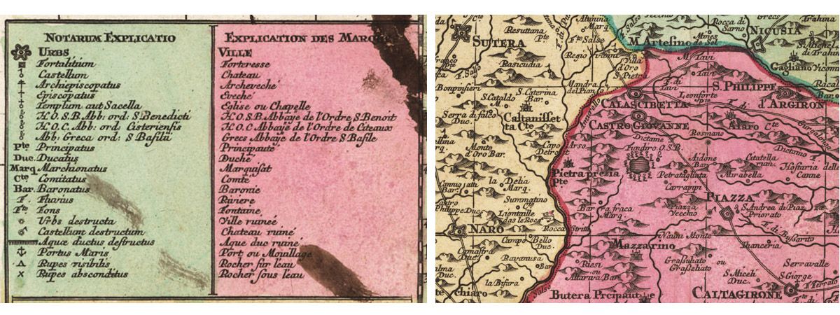
Seutter has included his traditional list of features, in both Latin and French. The list includes cities, chateau, archbishoprics, bishoprics, churches and chapels, a number of abbeys, principalities, duchies and some designation of ranks of the aristocracy. Seutter also had an eye for remains of antiquity, and provides a key for places such as cities in ruins, castles in ruins, and aqueducts in ruins. There also appears to be a healing center dating to antiquity in the region of Castro Giovanne. It is indicated by a small (very possibly sulfurous) spring around which Seutter has included fourteen miniature Rods of Asclepius. He also lists a number of important ports. Below these lists is located the distance legend.

The title cartouche contains characters from mythology including Neptune seated at water’s edge with trident on hand. Demeter stands behind him with a basket of fruit, a full to overflowing cornucopia, and some other agricultural products nearby. Dionysus stands opposite her with his staff entwined by a grape vine. Mermen emerging from the sea appear to bring offerings to the gods, and myriad sea-going vessels of various types sail the seas near the island.
The lower left quadrant contains an inset map of the islands of Malta and Gozo labeled “Carte Particuliere del Isla de Malte et des Isles Voisines”. Both islands are depicted with their countless castles and other architectural edifices.
Like antique maps and history? Follow me on Steemit and visit my website where you can buy antique maps with bitcoin (https://www.hjbltd.com)
We also sell fine print reproductions at (https://www.thevintagemapshop.com)
Hi! I am a robot. I just upvoted you! I found similar content that readers might be interested in:
https://www.hjbmaps.com/products/1730-mappa-geographica-totius-insulae-et-regni-siciliae
12.92% @pushup from @mapman5000
This post has received a 5.17 % upvote from @boomerang thanks to: @mapman5000