Naiguatá Peak @ Ávila Mountain, Venezuela
Searching for some peace I decided to grab my backpack and go to know the highest point of the Coast range and the second highest point of the Caribbean: The Naiguatá Peak (2765 m.a.s.l.).
Starting the route in the city of Caracas, you take a bus that leaves you at the foot of the mountain and you start walking through a dirt road under eucalyptus until you arrive to La Julia Station (1140 m.a.s.l.), where permits are requested to the wardens.

From here a path opens under the shade of large trees and with its roots making natural steps. You continue climbing until you reach El Mirador (1450 m.a.s.l.) that has this great view of Caracas:

At this point two roads open: one on the right that goes by Dos Banderas, which is a shorter path, but more inclined and does not have the shadow of the trees; the other on the left on Route 77 that goes up through the jungle entering the different valleys to the camping site called Rancho Grande. We decided to take the shorter one.
At the end of this climb you begin to feel a change of environment and vegetation, where the large trees give way to a bamboo forest and after a steep climb you reach Topo Goering (2470 m.a.s.l.), an interesting rock formation.

From here there is a short road to El Urquijo, where you start to see the Caribbean sea.

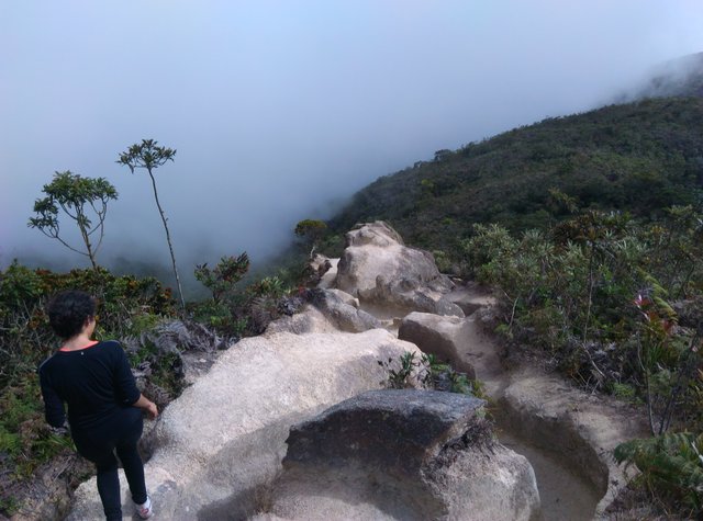
After this comes my favorite part: Fila Maestra (2550 m.a.s.l.), the path that runs along the crest of the mountain. The best thing of this are the views: on one side the valley of Caracas city and on the other the central coast and the Caribbean sea.

Everything starts to get rocky and you know you're getting to Platos del Diablo (2690 m.a.s.l.).

From here appears the low vegetation.

And the signs tell you that you are getting close.

When we arrived to the Amphitheater (2700 m.a.s.l.) it was already getting dark, so we decided to set up the camp here and continue to the peak on the next morning. This is me watching the sun going down.

We woke up with the sun to finally reach the summit.

Here's a view of our camp from the heights:

Just after a 15-minute walk, you get to a large metal cross and you're able to enjoy the view that Naiguatá Peak (2765 m.a.s.l.) offers you.

You feel like you're floating.

The cold up here was crazy. It wasn't raining, but my friend's hair got wet with the fog.

This was amazing and the only way to improve it was by being there at sunset, so a few hours later we went up again.


The sky mixes of colors between the clouds is just sublime.

I mean, just look at these colors!


The time in the ascent to Naiguatá Peak is around 7 hours. Hope you enjoyed the view!
Increíble! Nuestro país es maravilloso y es grato recordarlo a través de tus capturas.
Me alegra que mis fotografías te evoquen a tus tiempos en el país ♥
Congratulations, Your Post Has Been Added To The Steemit Worldmap!
Author link: http://steemitworldmap.com?author=kriistt
Post link: http://steemitworldmap.com?post=naiguata-peak-avila-mountain-venezuela
Want to have your post on the map too?
Congratulations @kriistt! You have completed the following achievement on the Steem blockchain and have been rewarded with new badge(s) :
Click here to view your Board
If you no longer want to receive notifications, reply to this comment with the word
STOPTo support your work, I also upvoted your post!
It's better to hang out with people better than you. Pick out associates whose behavior is better than yours and you'll drift in that direction.