SLC S22W2 / Using GPS with your cell phone
Hello everyone! I hope you will be good. Today I am here to participate in the contest of @soywilfredg about Using GPS with the cell phone. It is really an interesting and knowledgeable contest. There is a lot to explore. If you want to join then:
Create a new project in the UTM Geomaps application with a name and description
First of all before creating the project we must have UTM Geo maps application. So I will show how to download the application from the Google Play store to use it. Here is the step by step guide:
- First of all head towards the Google play store.

- There at the bottom we have to choose the search option to search it manually and download it.
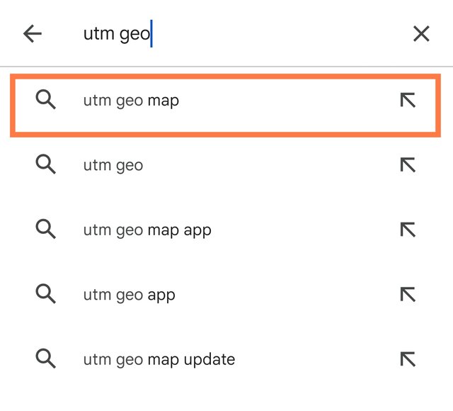
- Here I typed UTM Geo and I got some suggestions and at the top I got the suggestion of UTM Geo map. I selected it to search.
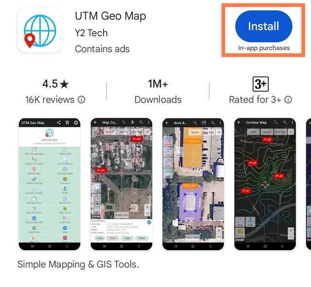
- It led me towards the UTM Geo Map application. I selected it to install in my mobile device to use it.
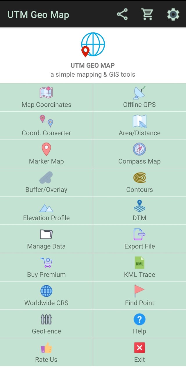
After downloading and installations I have opened the application. And it is the first look of the application which I got right after opening it. We can see a number of options in this interface.
Now I will create a project according to the requirements. Here is a step by step guide to create the project and to add the description of the project:

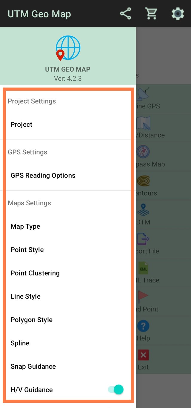
First of all we need to navigate to the top of the application. At the right most corner there is the settings or gear ⚙️ sign. We need to select this to open the menu.
 |  |
|---|---|
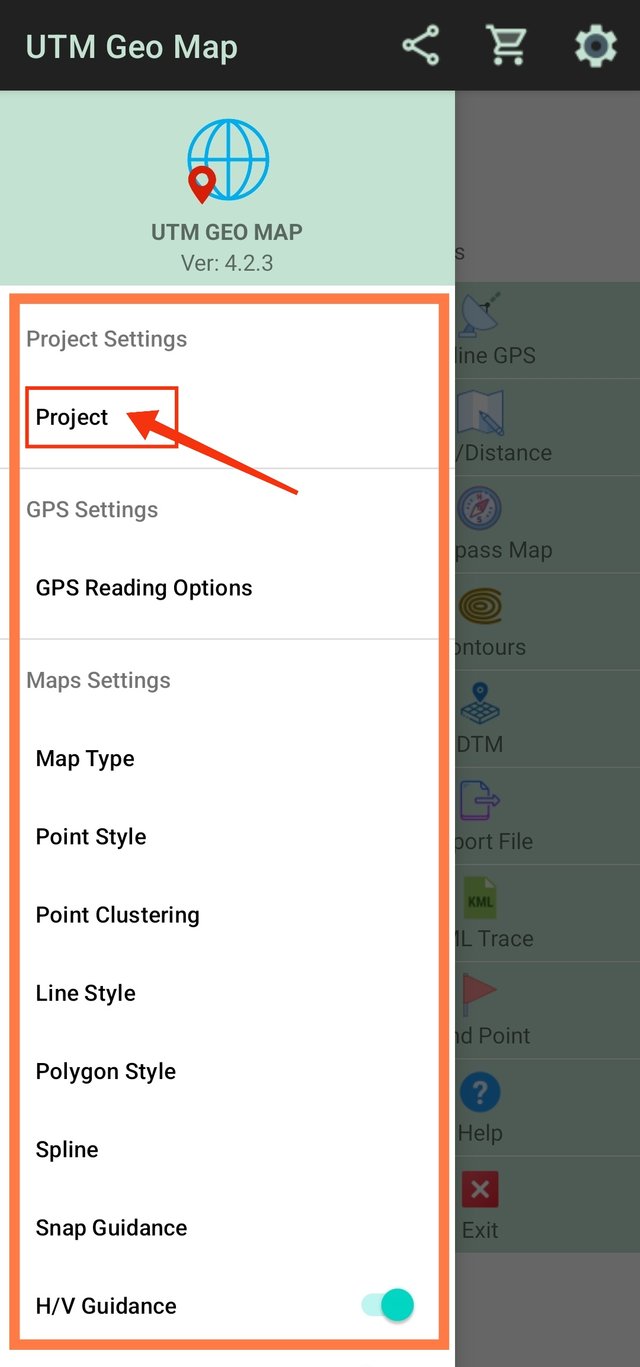
| It has opened this new interface at the left side where we can see a number of options. | Here we have to select the project option. It will show further options about the project. |
 |  |  |
|---|---|---|
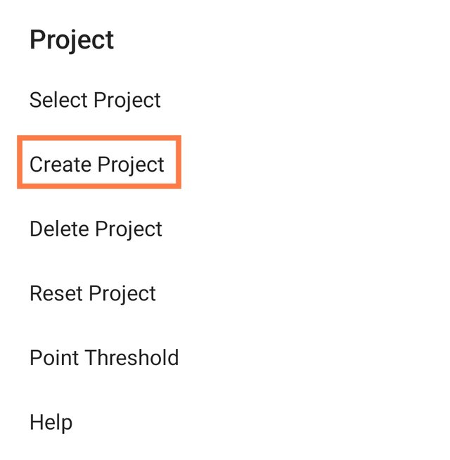
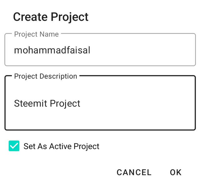
| Selected create project | Give name and Description | The project has been created. |
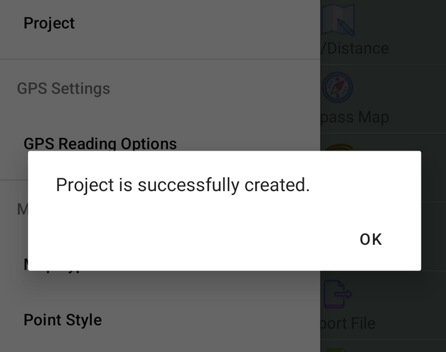
Here you can see I have given the project name mohammadfaisal and I have added some description for the project as well. Moreover I have set this project as an active project. In this way this project will be active. And after clicking ok the project has been created with the given name and description.
Take at least 4 points (on offline GPS) of places of your choice (they can be stores, squares, shopping centers, cafes, parks, museums, schools, whatever you prefer) and at each point you take, you must additionally take a photograph with your phone (If possible, you must appear in at least 2 of the photographs in those places)
While using this application I have become fond of this and my most favourite feature of this application is it's offline usage. It's amazing that we can use GPS system with little precision offline. I enjoyed it even while traveling here and there and to unknown places as well.
So let us start using the offline GPS and add some points in it.
For using the offline GPS we need to open the application and we need to find Offline GPS option in the application.
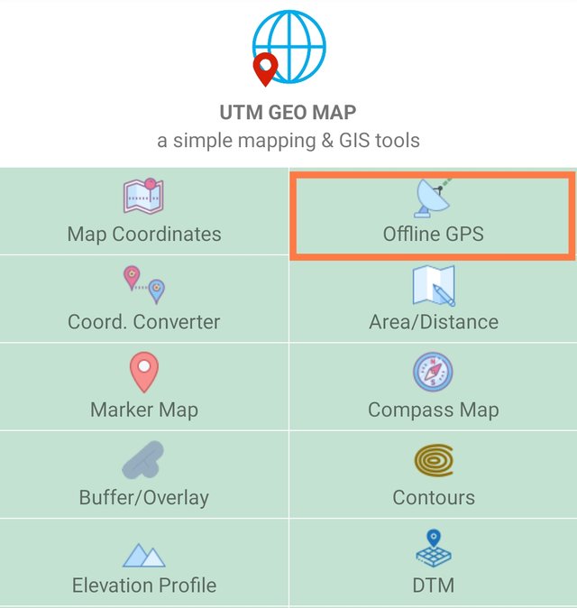
Here I have pointed out the option with the box. It is the option to use offline GPS in UTM Geo Map application.
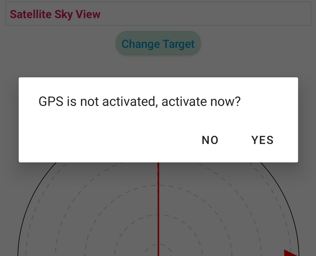
When we click on this a new window open there and it asks for the GPS permission to use it. So we need to allow location to use by this application.
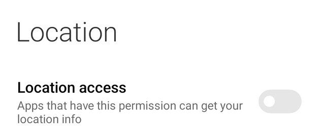
Here I have given access of the location to UTM Geo Map application so that I can use offline GPS.

Here you can see UTM Geo in the recent permissions given for the location to applications. It means the location access is now given to this application.
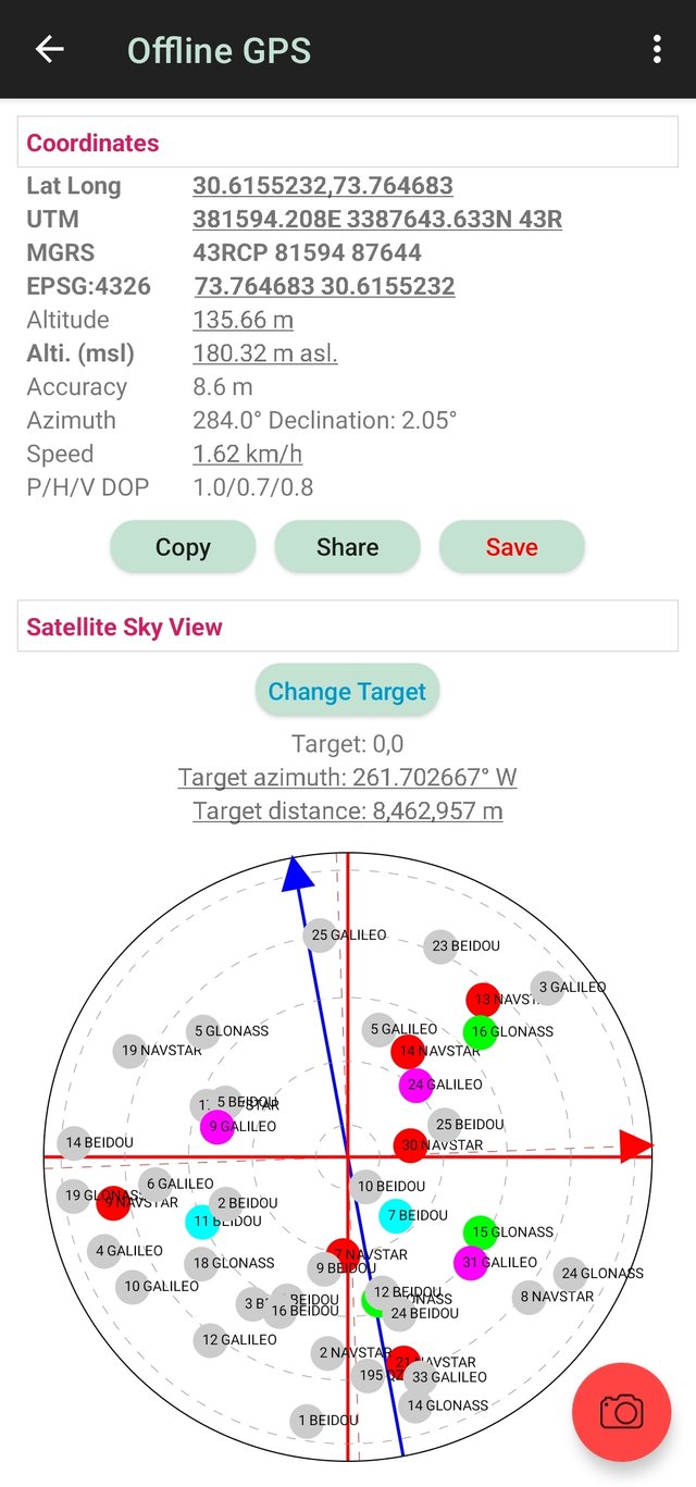
After turning on the location or GPS offline GPS looks like this. We can see the values of latitude and longitude as well as other values which a GPS should have.
As I have already created project so now I am using that project and all the points will be saved in that project.
Point 1
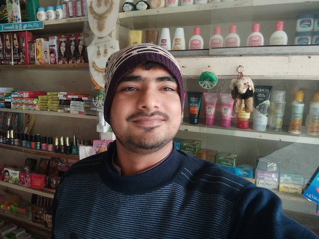
My first point is about the general store. I went to the general store near me and I saved that location in the project by using the offline GPS.
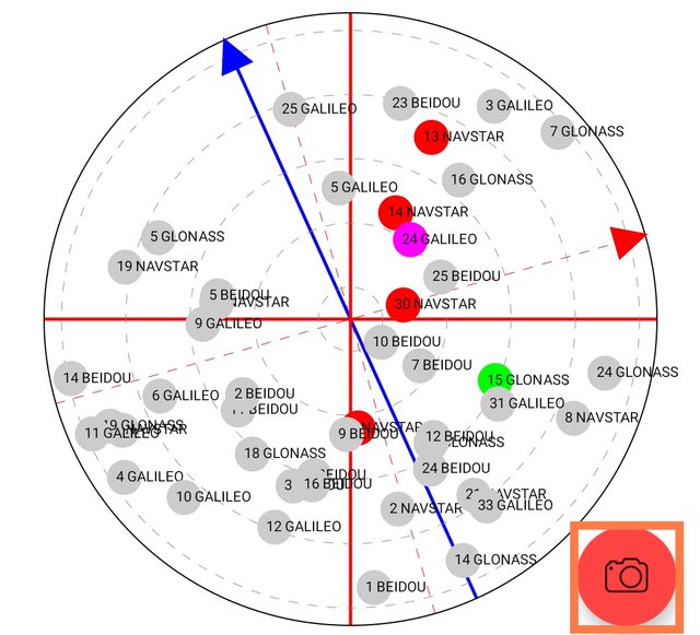
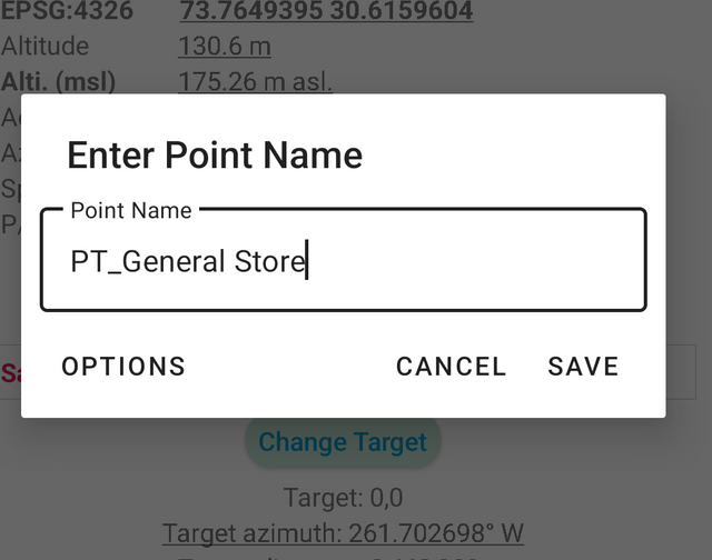
In this point I added my picture standing at the general store where we can get cosmetics, stationery, socks and other things. It adds picture at that point. We can add any picture.
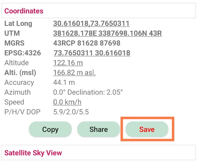 |  |
|---|
Then in order to save this point and to add it's name I clicked on the save option and then we have to give the name of that point and click on save. Now the point has been saved in the project.
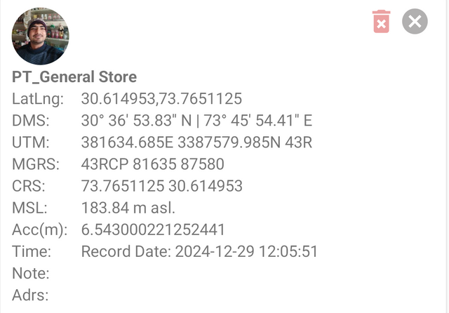
Here you can see the information of this point. My picture is visible at the top. Then there is the detail of the location. There is the information of latitude, longitude, UTM, DMS and more.
Point 2
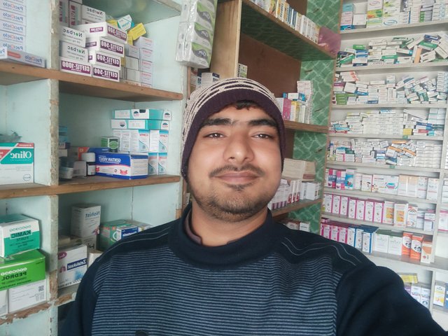
Here you can see the place for my second point. While returning back to home from the general store I visited medical store to get some medicines for my mother. I took advantage to add this point as second pint for my utm geo project by using offline GPS.
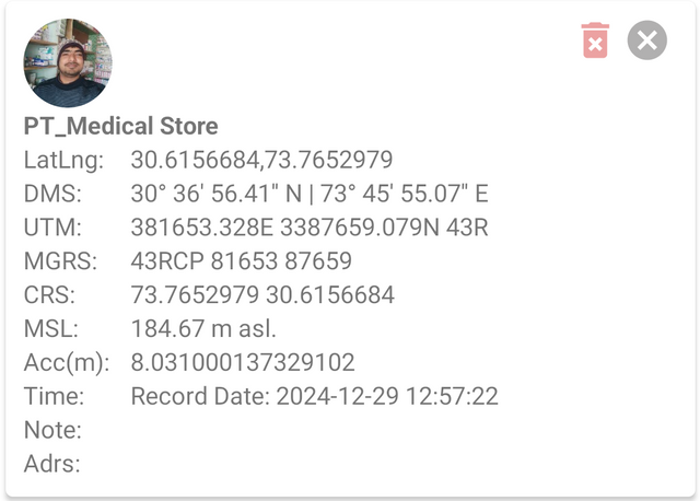
Here I added my picture in this point while staying at the medical store. It was the same procedure to add picture and to save this point with unique new name. My picture at the top and all the remaining details gotten by the god are visible in this picture of the point.
Point 3
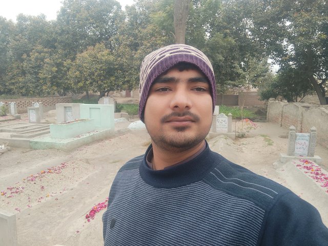
I added graveyard as my third point. I visited the grave of my father. The graveyard is near my home. I reached there within minutes and I took the opportunity to add this point in my project using the offline GPS. I prayed for my father and then I returned back from the graveyard.
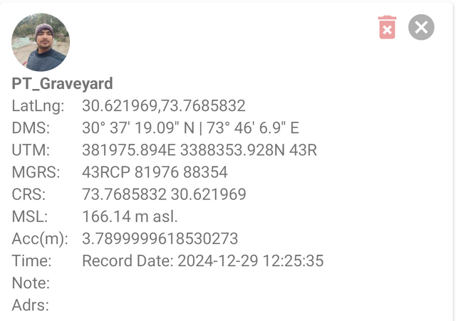
While staying there I added graveyard as my third point in the project. I added my picture at the top of the point by using it's camera feature. Then I saved the point with the name Graveyard. I added this name along with the by default name.
Point 4
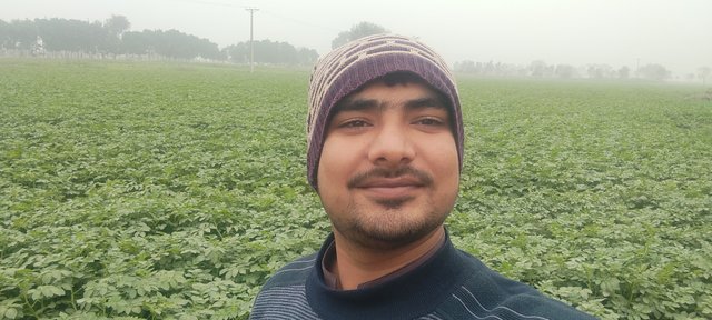
After returning from the graveyard I went to visit the fields. These are the potato fields. This field is ready to harvest and to pull out potatoes from the earth. I am adding this as my 4th point. These are the vast fields and in the surroundings there are also fields. It was cold and fog due to which in the picture in the long sight the view is was blur.
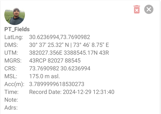
Here you can see I have added my current picture in the point from the camera section and then I have saved it with the name fields. It is showing all the details of that point obtained by the GPS.
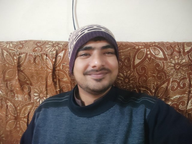
I have added this point of my home location. I was sitting and I was thinking to add another location as well and suddenly my mind clicked to add my home point.
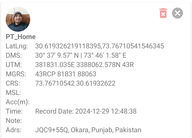
Here in this point I also added my picture by using the camera section. Then I saved this point with the name home as visible in the screenshot. All the detailed obtained by this offline GPS are added in the point.
So I have added these 5 points in my project. It was amazing using and adding these points. At first I was feeling it difficult to do but after learning from the lecture deeply and exploring the application I became able to do it.
Export the points you took and share them with me on my telegram, my username is @SoyWilfredG You must send me the KML file + your username, so I know who it is.
It is very simple to export file of the project in the UTM Geo Map application.
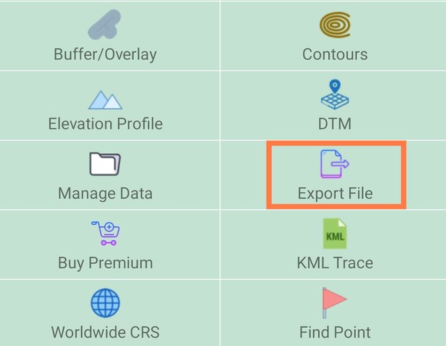
After adding all the data of the points simply go to the home screen. As I have highlighted in the above picture we can see the option Export File. This is the feature of the application from which we can export the project file.
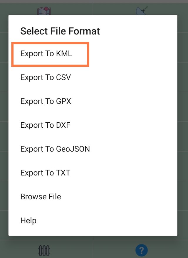
After clicking on this option we see different options about the format to export. There are different options as we can see in the picture. We can export it as kml, CSV and other formats. But as per the requirements we need to select KML format.
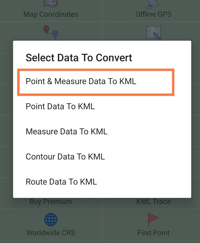
After selecting the format we need to select the properties which we want to add in the project while exporting it as an external resource. Here I have selected points and measurements data to export externally. After the confirmation of this we need to proceed next.
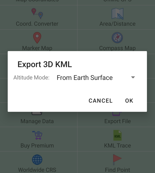
Then we can see the option altitude mode. At this point we can select our desired altitude mode. I am proceeding this export by selecting the default option which is From Earth Surface.

Now this is almost the last step of exporting the points as the external project file in the format of KML. Here we need to give name to the file. It gets automatically name of the project which we set while creating it.
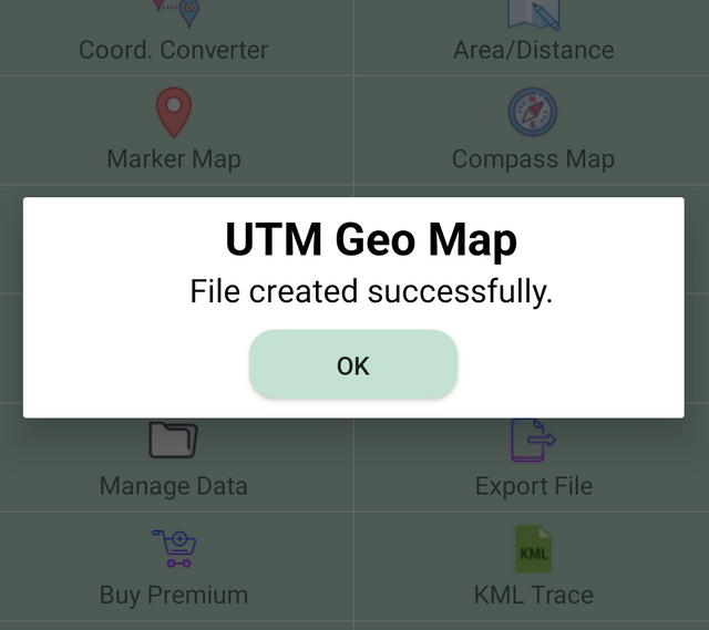
Here you can the confirmation pop up from the application that the file has been exported successfully.
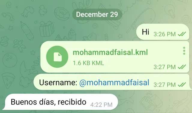
After exporting the complete file in the KML format I have sent it to the professor and he has received this entry.
Why did you choose those places? Do they represent something important to you or is it just a place you were in?
All the places which I have chosen are the common places in daily life for everyone especially for the people of my area and myself. Each place is special and holds itself's importance.
Home
There is a famous quite for the home which is home is where the heart is. So the home is very important place not only for me but for everyone. The comfort and peace which we get at home is not possible anywhere else. I chose my home as it is the model of love which was built by my beloved father. We all live happily. I want to an interesting thing that I am the university student and I travel around 100 kilometres daily basis to go and come back from university but I prefer to live in my home not in my hostel. There are many other reasons as well but I think these are enough to share.
General Store
General store is the place to which everyone interacts to get the daily provisions of life. So I added this to my project as a point because I often interact at this store to get the cosmetics for the daily usage. If I need something related to hosiery I also come at this store and buy these things. Even if I need stationery I come here and buy stationery related things from here. If I need toys for the children then I also visit this general store. And I think it is the part of everyone's life to visit the general stores.
Medical Store
Medical store is also the part of our daily life because whenever we are not feeling well and are ill then we visit the medical stores to bring the prescribed medicines by the doctor. I have spent some years at the medical store as well and I am familiar with the medicines as well and this is also the reason I added medical store to my pints. There is no doubt everyone visit medical stores to get medicines for himself or herself or for others. Medical stores play an important role in our daily lives.
Graveyard
Alas! We have to die one day as we are here to decay. There is no one who can live forever on this earth. Bring Muslim graveyard is the sacred place for me. One day I also have to come here and it reminds me about the death of my beloved father. And in this graveyard there is the grace of my father as well. I visited this graveyard and the grave of my father and this is also the reason I added it to my project as one of the points.
Fields
We cannot live without the fields. These hold a lot of importance in our lives. If there are no fields then there is no food for the living organisms because everyone depends on food for living. So I visited it as an important thing of our society. Moreover greenery looks very beautiful and it gives comfort and calm to the eyes. This is the season of the potatoes so these were the potato fields in the vast area. I think everyone is aware of the vast contribution of potatoes in life because there are used in a lot of dishes. So I added this place in my project.
In your opinion, is it important to know how to use a GPS? Why?
Yes it is very important to know how to use a GPS in modern life for several reasons. Here are some reasons:
Reliable Navigation: A GPS technology provides good and correct directions so as to move without any stress because of its proper direction at any place with whatever transport medium you are travelling through-driving, walking, cycling etc.
Time Management: Modern GPS systems analyze traffic conditions and suggest the fastest routes, helping you save valuable time during commutes, road trips, or daily errands.
Safety in Emergencies: In critical situations, GPS can be a lifesaver, guiding you to nearby hospitals, gas stations, or emergency services, especially in areas where help might not be immediately visible.
Outdoor Adventure Support: If you are a hiker, camper, or explorer, you can feel safe while hiking through the wilderness because GPS minimizes the chances of losing your way and increases overall safety.
Use Everywhere: GPS is a global tool used by any traveller who has to navigate through foreign countries where communication may be a problem when using the traditional map.
Enhanced Planning: Beyond directions, GPS aids in planning trips, finding points of interest like restaurants or attractions, and estimating travel times, making your journeys more enjoyable and organized.
Technological Literacy: In an increasingly tech-driven world, understanding how to use GPS reflects essential digital literacy and prepares you for integration with modern tools and apps.
Mastering GPS not only promotes independence but also provides a versatile tool that is extremely useful for everyday as well as extra for the ordinary situations.
Now that you know how to use a GPS, in what circumstances do you plan to use it?
Global positioning system I read and learnt in different grades of my school. But I did not use it practically. I was not aware of using GPS practically before this learning lecture where I have seen it's practical applications. I have used GPS practically for the first time.
Now I am aware that I can use GPS in my mobile even when I am offline. I have never thought that I could use GPS with that precision level without internet.
Now I am fully trained to locate the places with the help of the GPS by obtaining latitude and longitude of the places. I can send my position by using GPS to anyone for the easy navigation of my location.
I am feeling very confident after learning to use GPS in my mobile. I am planning to use it whenever I need to know about my location when I am not aware about the place.
I plan to use GPS for the following situations:
- Travel to Unknown Places:
- When visiting a city, country, or even a region for work or pleasure or for errands.
- To go through the complex urban land or find specific addresses.
- Daily Transportation:
- It is about planning the fastest possible route to work or home with rush hours.
- Avoiding traffic jams or road closures with real-time updates.
- Outdoor Adventures:
- Hiking, camping, or exploring remote areas where landmarks may be scarce.
- Navigating trails or finding your way back to the starting point.
- Emergency Situations:
- Locating nearby hospitals, police stations, or emergency services quickly.
- Giving exact coordinates if you're stranded or in need of emergency help when out in some remote place.
- Delivery and Logistics:
- When sending packages or delivering foodstuff, get the correct dropping points.
- Find out the most efficient routes in order to conserve fuel as well as save time.
- Locate Points of Interest:
- Locating restaurants, gas stations, ATMs, or points of interest.
- Visiting local attractions or secret gems when travelling.
- Car Breakdown or Navigation Issues:
- Locate the nearest mechanic or tow service if your car breaks down.
- Navigating detours or back roads in case main roads are unavailable.
- Activities in Sports and Fitness:
- GPS tracking of the routes run, cycled, or kayaked around.
- Monitoring distances or elevations covered during working out.
- International Touring:
- Overcomes language barriers when navigating places in other countries.
- Offline maps when cellular signals are unavailable.
- Fleet Management or Professional Use:
- Manages delivery or transportation services efficiently
- Manages a vehicle or staff in real-time for commercial purposes.
GPS is absolutely essential where precision, efficiency, and safety are concerns, thereby making it one of the most useful instruments in both daily and professional activities.
My personal experience
Yes I have used this utm geo application for the god system when I was going to a place from which I was not aware. Actually it was the wedding of my cousin and we all family members and friends were going to the bride's home and we were not aware about the place and route fully.
At one place we stopped because the family members were behind of us and they were unable to find our car. I was with the groom in the car so I used my UTM Geo Map application and I obtained the exact location by using GPS. And by following those points they approached us. So it proved to be very helpful for me.
You've got a free upvote from witness fuli.
Peace & Love!