SLC S22W2 / Using GPS with your cell phone

Greetings Steemit friends
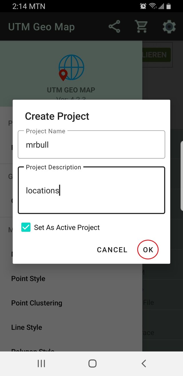
Create a new project in the UTM Geo Maps application with a name and description.
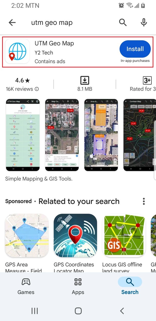
To create a new project on UTM Geomap, you need to have the application running on your Phone. For now, it seems like it is not available in the Apple store, so I will be using an Android phone. I try to give every step, so we don't miss out.
Visit the Google Play Store, which is available to any Android phone running with an active Google account. As of December 2024, UTM Geomap is about 8MB and can run on Android 5.0 and above.
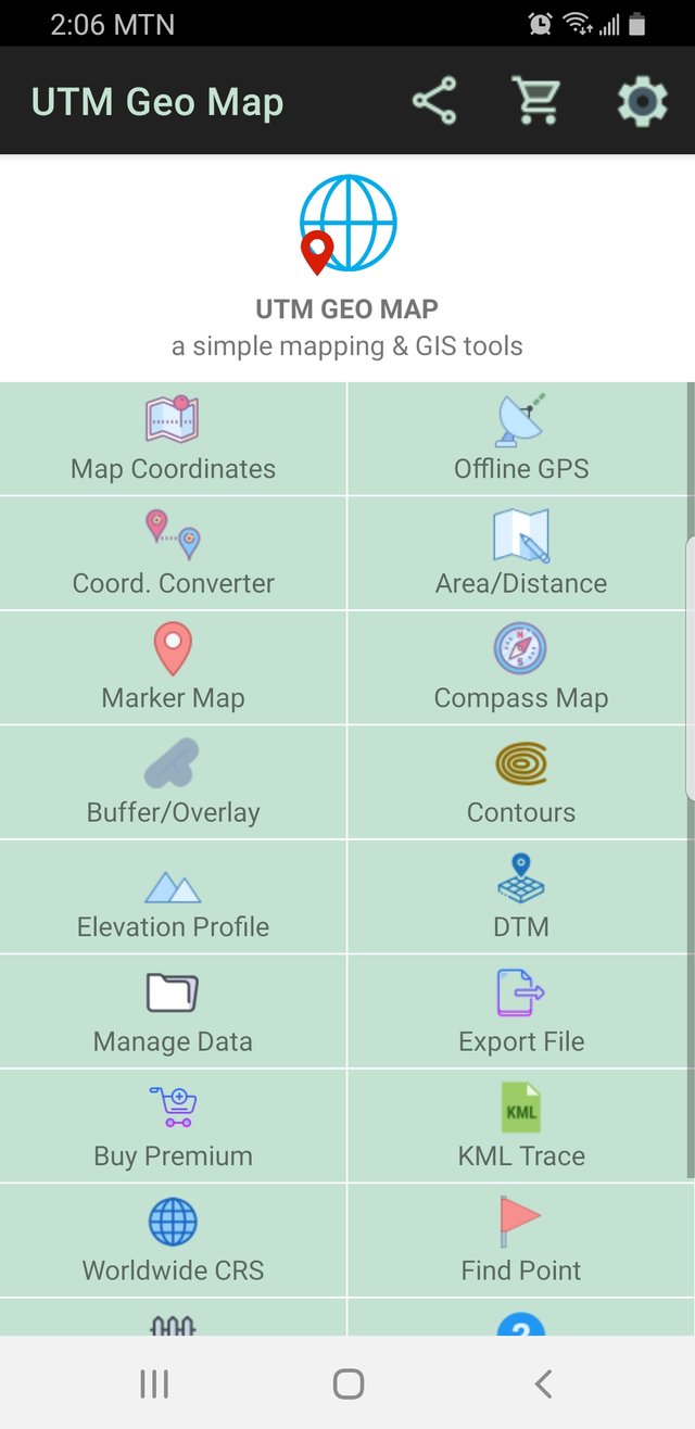
We have an application running on my phone. We have three icons at the top right-hand corner, that is a share icon, a shopping basket, and a setting icon.
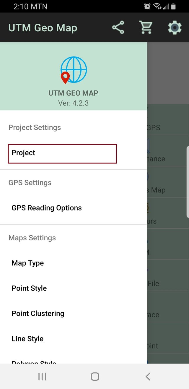
To create a new project, click the setting icon ( which is the last icon) on the far right hand.
A new window will open up, click project.
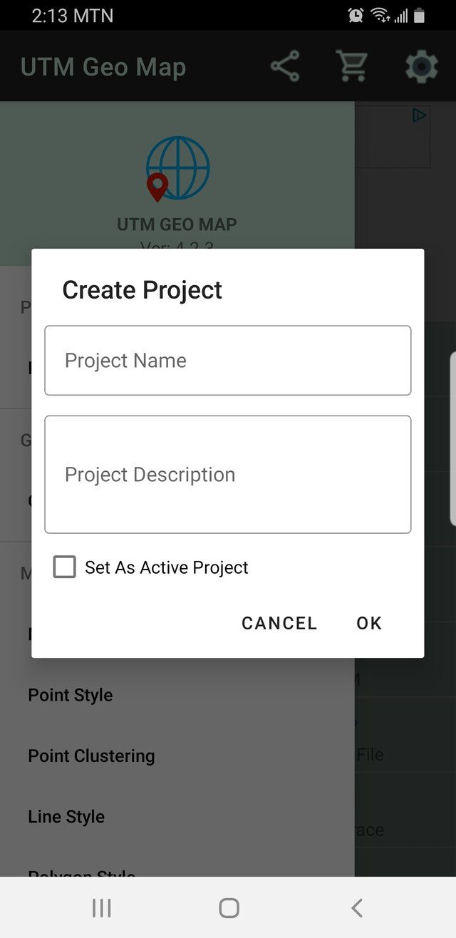
Here a popup will show with a list of options. Our task is to create a new project, so I select to create a project. The next popup will demand the name and description of the project.
I fill in the name of my project (mrbull) and the description of the project(locations). Since I want to use the project at the moment, I click the set as an active project option and confirm the project creation by clicking ok.
A confirmation window will pop up to notify that I have successfully created the project.
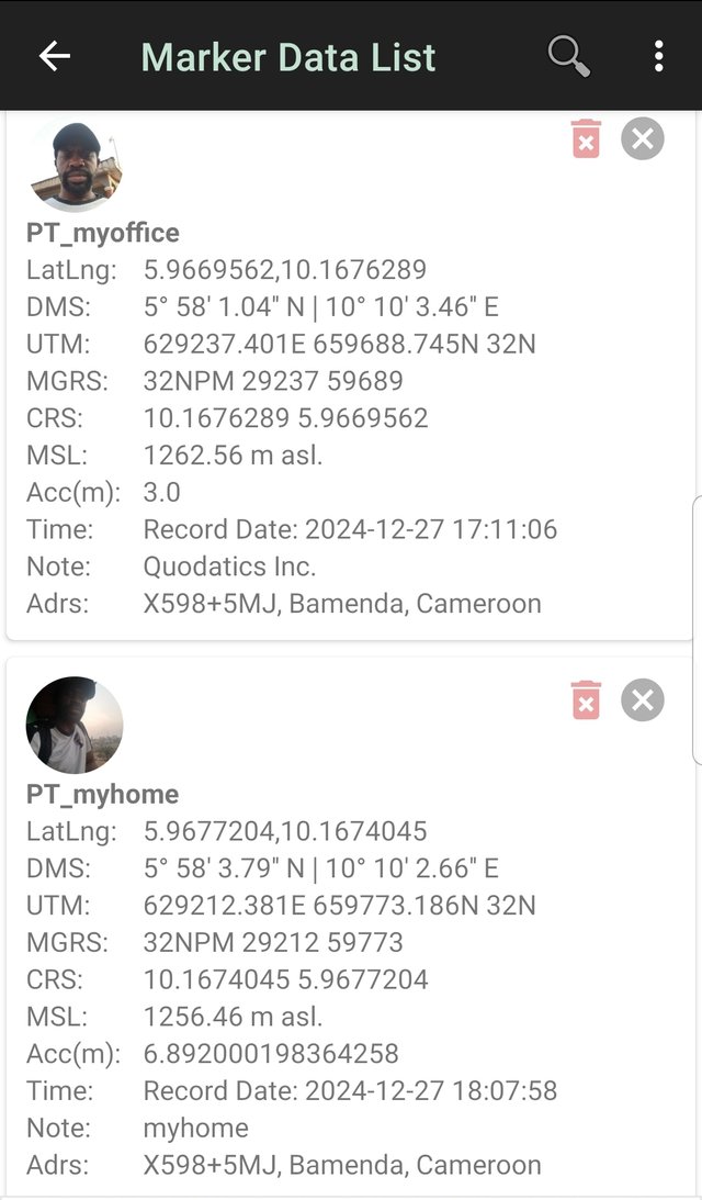
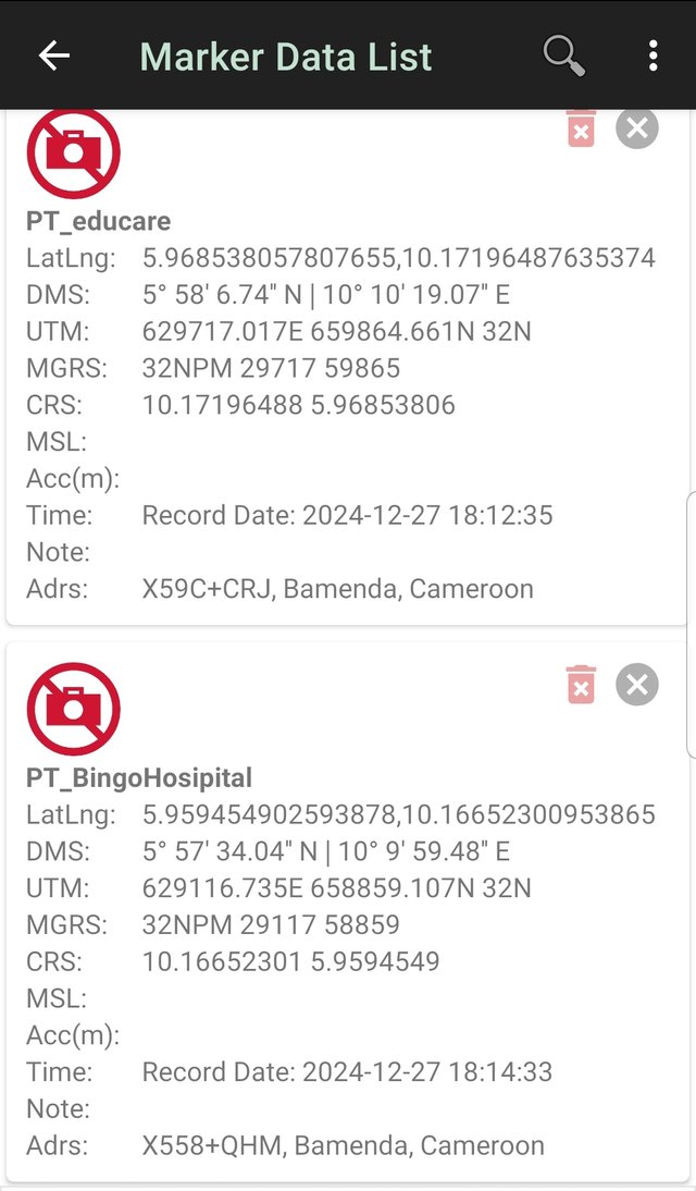
Take at least 4 points (on offline GPS) of places of your choice (they can be stores, squares, shopping centers, cafes, parks, museums, schools, whatever you prefer) and at each point you take, you must additionally take a photograph with your phone (If possible, you must appear in at least 2 of the photographs in those places)
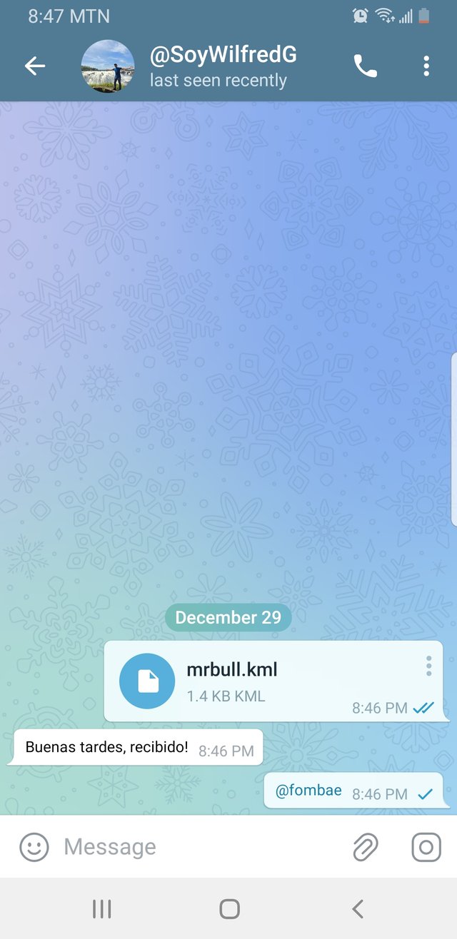
Export the points you took and share them with me on my telegram, my username is @SoyWilfredG You must send me the KML file + your username, so I know who it is.
Why did you choose those places? Do they represent something important to you or is it just a place you were in?
- Most of the places I pick are close to me and significant to me.
- 1: My Place of Work:
This is where I spend over 70% of my time during the day. It’s where I take time away from home to serve my clients. At the office, I am free from distractions and able to concentrate on my daily tasks.
- 2: My Home
A shelter is something every living being works hard for. My home is like a safe place for me, and it is the most comfortable. At home, I can connect with my family and enjoy privacy from external relationships.
- 3: Educare nursery and primary school
There is a nursery and primary school not far from my home. It was my kid's school and a place I visit every day. During school, I drop and pick them up from school.
- 4: Bingo Baptist hospital
It is the closest fully equipped hospital to my home. In case of emergency, we always rush with the kids to this hospital. Although they seem expensive, they are the closest to my home.
In your opinion, is it important to know how to use a GPS? Why?
Yes, for me it is important to know how to use the GPS. They can be helpful in many ways:
- GPS Helps us navigate areas unknown to us. When to turn right or left when going to an unknown location. I can even help with options when trying to avoid traffic.
- GPS Helps us save time by giving us options not to get into blocked areas that may be caused by an accident or traffic
With a good understanding of GPS, we have self-confidence when moving into a new location. This is because you know you can easily find your way out.
GPS can make life safer, by giving information about an area if it is a human habitat or vegetation (forest area). Forest areas can be risky, getting into wild animals or
Now that you know how to use a GPS, in what circumstances do you plan to use it?
When driving out of town, GPS can guide me to stay on the major roads.
GPS can help locate the nearest police station, or patrol point when in an unfamiliar location
In case I'm traveling on public transport, GPS can help me know where we are on the road.
GPS can be hell when moving around town, to identify a building or road junction
Cheers
Thanks for dropping by
@fombae

Hello @fombae, This project sounds fascinating, and I appreciate how you broke down each step so clearly. The places you chose to map, like your home, work, and hospital, are very meaningful, and I love how you explained their significance to you. GPS is indeed such a useful tool, and I agree with your points on its role in safety and efficiency. I also think the photos you took add a personal touch to your post. It would be amazing to see more images of the locations next time, to really capture the essence of each place. Great work overall, and I look forward to your future posts! Cheers!.
Upvoted! Thank you for supporting witness @jswit.