SLC S22W1 / Digital Cartography Basics

Greetings Steemit friends
Within the freehand map that you made, locate where the capital of your country and where the state/department/province where you live is.
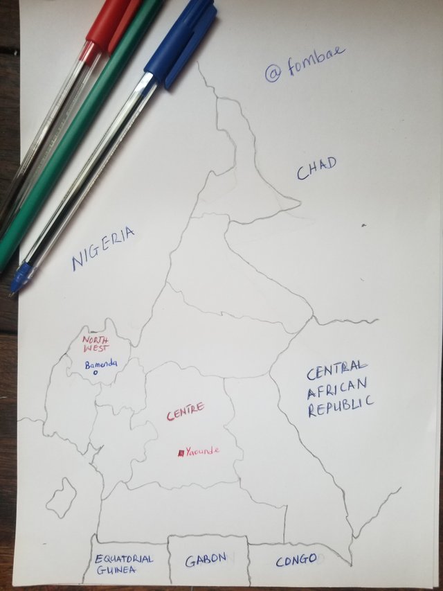
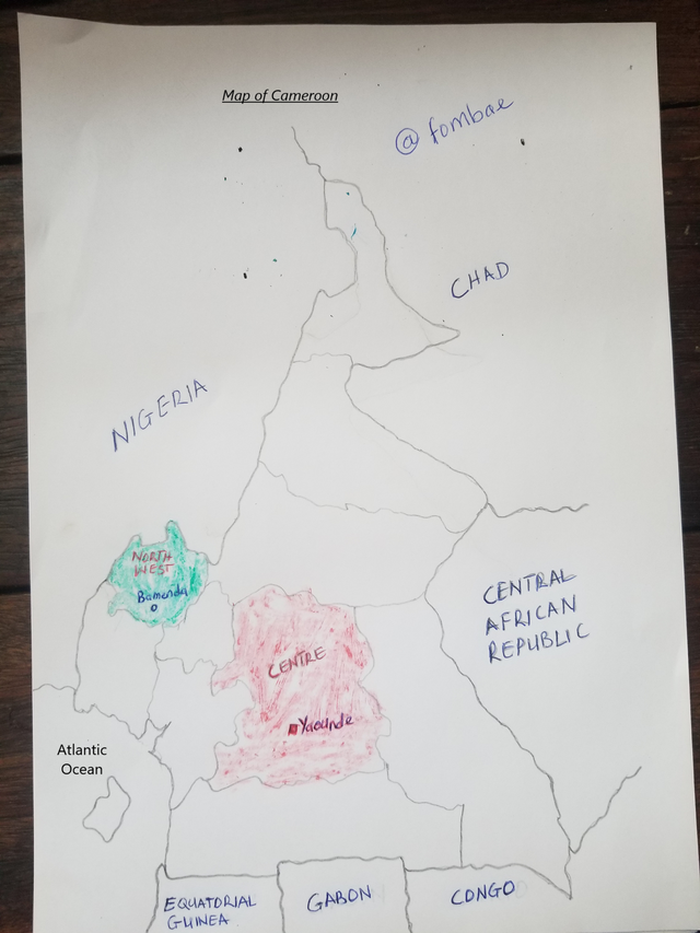
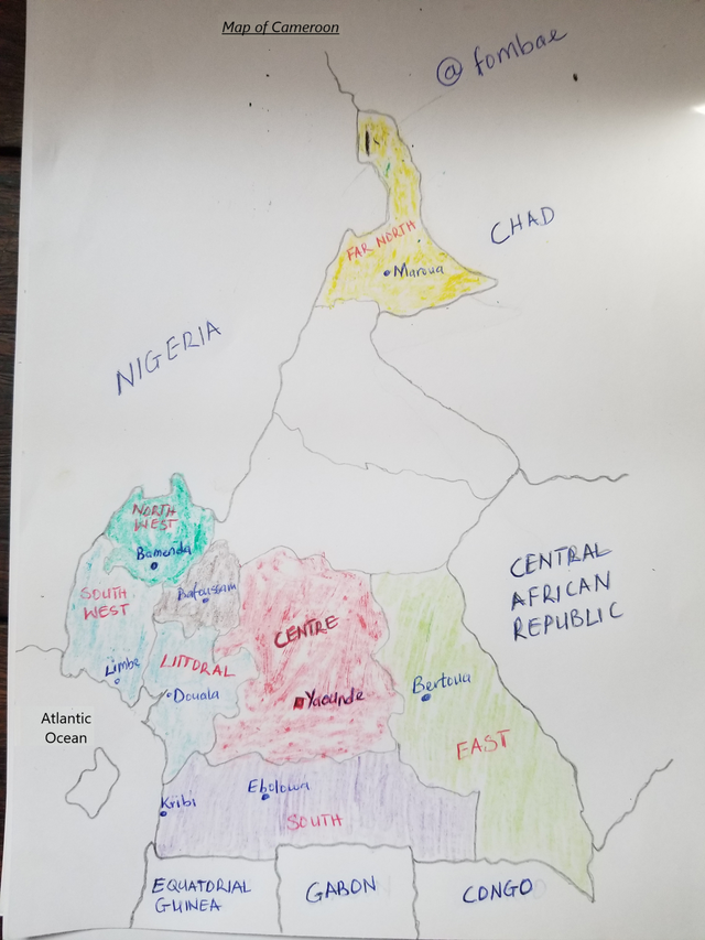
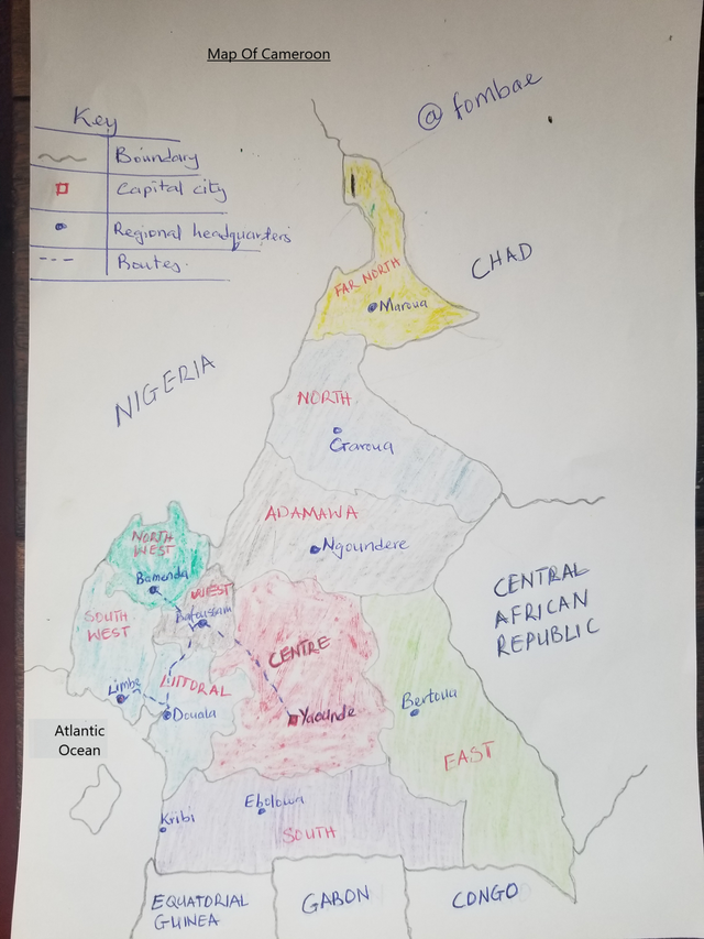
It has been a while since I did the activity of tracing a map. Cameroon is located in central Africa and covers approximately 475444 square kilometers. Cameroon should have a population of about 27 million as of 2023. Cameroon is bordered by five different countries. We have Nigeria to the west, Chad to the north, the Central African Republic to the east, and Congo and Gabon to the south. In the SouthWest, we have the Atlantic Ocean and Equatorial Guinea. Cameroon is made of ten regions, which were formerly called provinces but later constitutionally changed to regions. Cameroon has two regions that are English-speaking, and the rest (nine) are French-speaking
I managed to trace the map of Cameroon and separate it into the different regional sections. The capital of Cameroon is Yaounde, which is located in the Center Region. I have colored the central region red to differentiate and give it power significance.
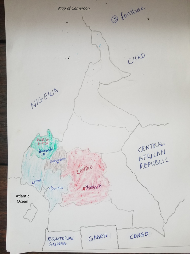
I currently live in the North West Region specifically in the urban city of the region Bamenda. Bamenda is located in one of the English-speaking regions in Cameroon.
Locate within the map you made some states/departments/provinces that you know by heart (Only those that you know/remember at that moment, do not deceive yourself by cheating)
Most of the regions I know by heart are regions I have lived or visited regularly. You can see Limbe, which is technically my home town. Limbe is located in the southwest region of Cameroon, which is also one of the English-speaking countries. Limbe is bordered by water on the south (Atlantic Ocean) and is one of the tourist cities in Cameroon. Next to Limbe, is Douale in the Littoral region. It is the economic capital of Cameroon, and the door to international flight. I mentioned Bafoussam, which is close to Bamenda. For you to travel to Limbe or Douala, you will have to pass through the city of Bafoussam.
Mention 3 places in your country that you still don't know and that you would love to visit and why.
Here, I will mention 3 regions I'm hoping I have the chance to visit in the future. That is the South Region, East Region, and Far North. In the South region, we have the Tourist city (Kribi) which has a beautiful beach and a number of waterfalls (Lobé Waterfalls, Ekom-Nkam Waterfalls, etc). There is a lot of talk about the city, more reasons why I want to visit and see for myself.
Next to the south region is the East region. This region is made of Equatoria Green forest, with several wildlife-protected areas. The current president of Cameroon is from the South region. Bertoua is the capital of the south region.
The far North region is the third region I would love to visit in cameroon. The capital of the Far North region is Maroua, and most of the people are of the Muslim religion. Most interesting in this region for me is the Waza National Park, which is located in Maroua. I really want to visit that part someday. The region holds a number of traditional Fulani architecture.
Reply:
- What is a map for you?
A map is a representation of an area on small pieces of paper. It will carry information about the area like locations, distance, roads, vegetation, topography, etc. A good map will have features like Name, Scale, Legend, Compass Ross, Label, symbols, etc. Maps can be a Topographic map(hills and land), Political (countries, regions, cities), Climate (rainfall or wealth partner), or Road (stress, highways, etc).
In other words, I can say a map is an illustration to have a better understanding of an area related to the topography, climate, infrastructure, and resources.
- In your opinion, what are the most important elements to understand a map and why?
The three elements that will help me understand a map faster
Legens(key)
The Key gives meaning to the symbols, colors, and markings on the map. With the key, you are not able to identify and understand the features on the map such as roads, parks, hospitals, cities, etc.
Labels
Labels are the act of naming on a map. I can only identify the area on the map by reading the label. Be it a geographical area, water body, different countries, etc.
Color and Symbols
Color symbols are used to represent features, which help me recognize and interpret the different features on the map.
- In your opinion, is cartography important or not so important? Why
Cartography is important as it helps in navigation, planning, management, and development of many areas. I'm more details
Cartography helps travelers to understand distance, routes, and directions which makes movement more efficient and safe.
Cartography is a tool used for urban planning, which goes ahead helps in infrastructure development and resource management of an area.
Cartography can be used to manage environmental conservation areas. With cartography, we can track vegetation, wildlife habitats, climate change, etc.
Cartography helps to connect people, we are able to make use of a transportation map to follow routes to other areas of the world.
@soywilfredg, please seem you missed my entry. Or did I fall out of the rules?
Thanks
Hola, amigo! no copiaste el enlace de la publicación en el post original y esa era una de las reglas. acá Te dejo el post original para que le eches un vistazo a las reglas y criterios.
So what the purpose of the tag ?
Personally that's doesn't make sense to me. Anywhere thanks.
FUNNY!