Strange time's, strange marking's
I've been consumed lately by the topic of ancient inscribed stone's.
Whilst out on my hike's, I've been examining large boulders and farmer's gate post's for any kind of ancient inscription's, in particular, the ancient British alphabet of Coelbren.
Many of these stones which once littered the landscape in Wales are believed to have been removed by organisations determined to keep the REAL history of Britain suppressed. However, that is a topic for another day.
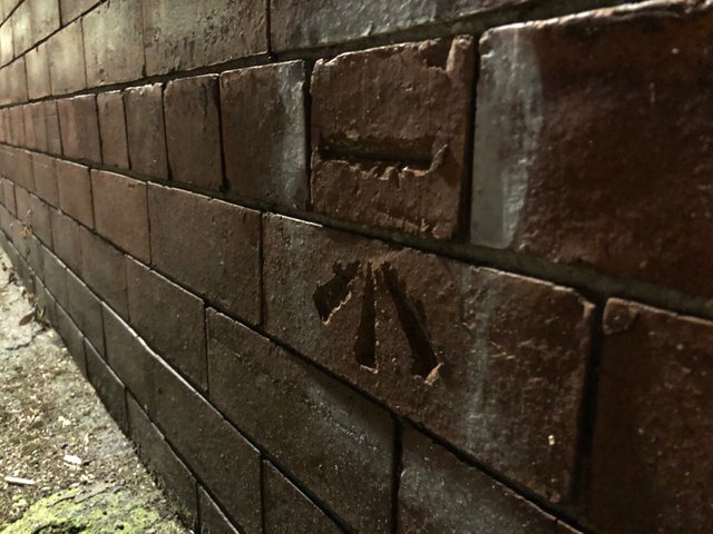
During my fruitless effort's to find some King Arthur era etching's and whilst utilising my new found skill of wall watching I stumbled upon a strange mark cut into the brick wall of a pub.
I took a snap of it out of curiosity and didn't really give it a second thought until I came across another one, a week later and not far from the first.
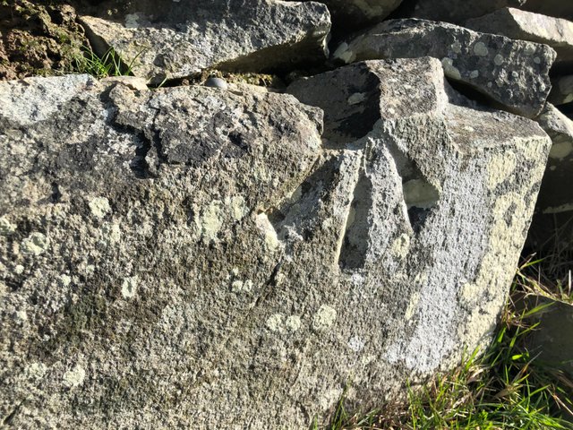
The second, unlike the first, was only partial and some of it had been chipped away at some point in time. I did well to spot it among the crumbling stone wall it was situated on.
My curiosity was now peaked and as I continued with my walk that day, I imagined that I'd found some kind of hidden clues on a treasure map and frantically scanned every wall I came across for evidence of another.
What could they be? The lines are equal in length and depth and look professionally cut. Although similar to a stone mason's mark, I quickly ruled this out as the first had been found spanning two separate bricks indicating the mark's had been made after the structure had been erected. Also the two that I had documented were cut into two different materials. One on brick and one on natural limestone.
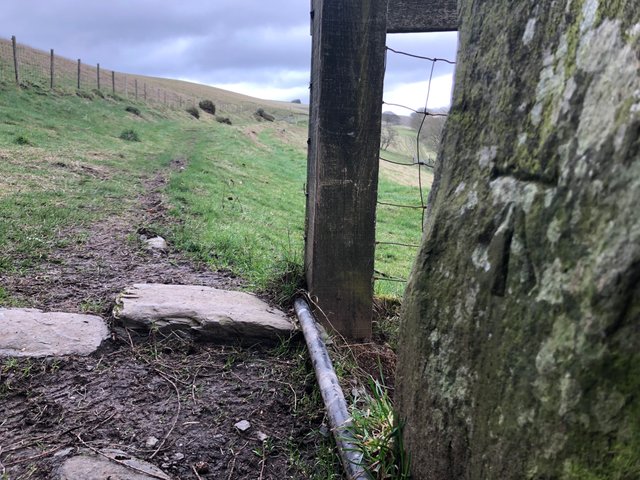
A few weeks passed before another one popped up. This time it was spotted by a friend who I'd recently shown the pictures of the two I'd already found. Exhilarated by his find, I amused myself watching the mystery take a hold of him. We joked we used to enjoy the scenic views until these little bastards came into our lives!
This one was located on an old farmer's gatepost on a trail in the middle of nowhere. I'd had a quick look online for anything identifying the 'Blair Witch' like symbol's but didn't really know what to search for!
Ordnance Survey Benchmark's
Sat at home that evening and determined to get to the bottom of this, I punched "STRANGE MARKS ON WALLS" into the search engine on my browser.
As I trawled through the catacombs of the internet I came across a blog post by a guy who was travelling the UK examining equally bizarre and historical marking's on kerb stones.
On his blog post was a photograph of one of my mystery mark's as an example of marking's he was omitting from his research as they were known to be 'Ordnance Survey (OS) Benchmark's'.
I'm a huge fan of OS, everyone's favourite cartographer's of the British Isles, so you can imagine my shock when I read that these little marking's were once an important part of mapping the country.
Ignorantly forgetting that GPS, satellite technology and aerial photography haven't always been a thing, it's interesting to see how our Victorian ancestors recorded accurately the contours of the country.
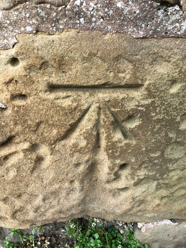
Many of the mark's cut into sandstone have sadly disappeared with erosion, although some, like this one remain prominent
The horizontal groove would have been used to support a stable bench (benchmark) where a levelling stave would be placed on top. The design ensured the process could be replicated uniformly in the future.
Benchmark's were fixed points for measuring height above sea level. A huge network of half a million mark's were strategically set up across the UK with some dating back to 1831.
With the evolution of the mapping technique's came the redundancy of the network. A lot have been demolished, weathered to nothing or renovated over and almost all remaining mark's are no longer accurate due to subsidence.
Although the network is in disrepair, builders with an appreciation for these little historical scratching's will often work around them and sometimes tend to them if they're looking a bit sad. Also the awesome people at OS have a benchmark map layer on their online map's where you can locate all the one's that are still standing.
As a result I've picked off a few more this week whilst out on my bike during my government permitted 'one form of exercise a day'.
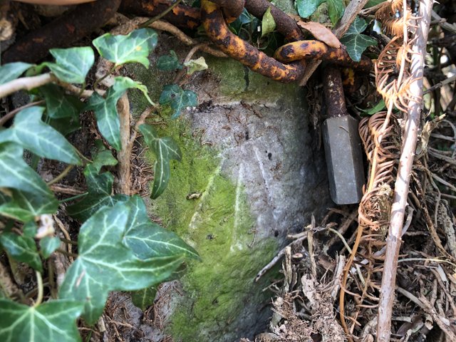
This one was buried behind a load of ivy next to an old padlock. It was pretty faded and the groove's were really shallow.
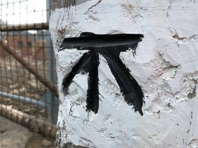
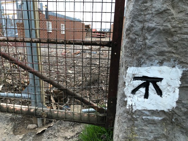
This last one is my favourite of my haul so far for obvious decorative reason's. Once I knew what these things were I've been scanning gatepost's as I drive and this bad boy stood out like a sore thumb!
It's positioned on a busy road at the entrance to a building site and has been inaccessible - Until lockdown that is. No traffic and no builders meant I could pull in on my bike and nab a couple of shot's.
As I mentioned before it looks like the builder's know the drill and have left this one standing.
It won't be long and all this craziness will be over and you'll be out wall-watching like me!
Please stay safe and thanks for reading.
