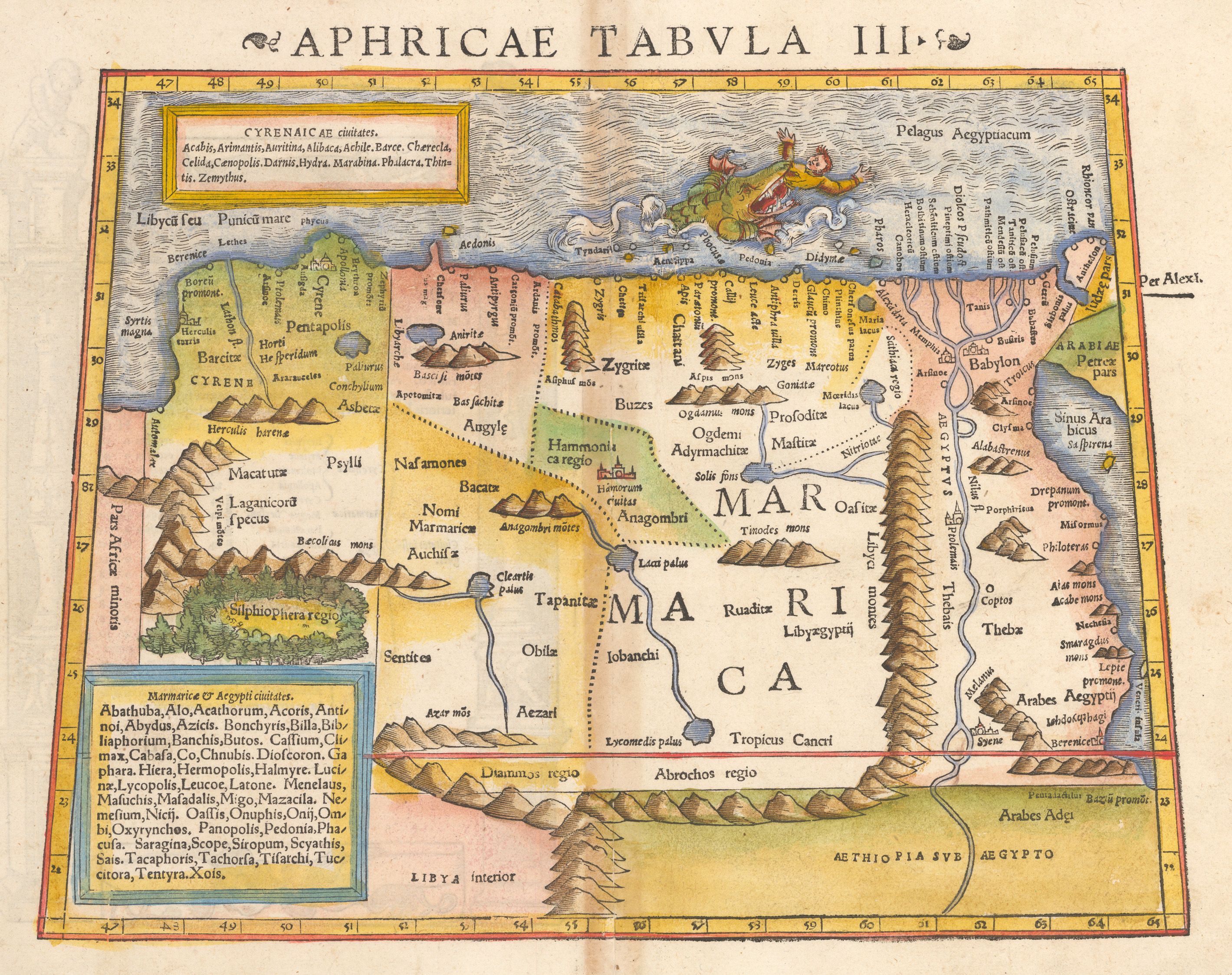
16th Century Woodblock Map of Egypt / Northern Africa by: Sebastian Munster

Aphricae Tabula III
By: Sebastian Munster
Date: 1552 (Published) Basel
Dimensions: 10 x 13.5 inches (25.4 cm x 34.3 cm)
This marvelous map of North Africa and Egypt is from Munster’s 1552 Latin edition of Ptolemy’s Geographia. The map is presented in a trapezoidal border, and the verso, featuring descriptive text in Latin, has an elaborate border of architectural details, ribbons, cherubs, and a vignette of a supine bishop. The entire region is rendered in exacting detail.
While at times misinformed, in general the map provides accurate topographic detail of northern Africa, starting from the northwestern tip of Arabia and extending as west to what is now modern day Algeria. The cities of the ancient Greek Pentapolis are listed, with Cyrene represented as a rather prominent city, indicated by the miniature buildings depicting it. The space between Cyrenaica and Egypt is less well represented, but still features numerous place names, mountain ranges, and tribal regions. Two insets at the top and bottom left of the map provide Cyrenaic and Egyptian place names of unknown location.
Munster’s depiction of Egypt and the Nile valley reveals considerable knowledge of the area, and includes the names of major cities, including those on the coast of the Red Sea. The mountains ranges featured in Egypt seem are curious, particularly the long range starting just below the Nile delta and running alongside the Nile all the way to Ethiopia may represent the eastern edge of Egypt, where rugged mountainous terrain runs nearly the length of Egypt’s eastern border along the Red Sea. Alternatively the mountains depicted could be in modern day Libya. Ptolemy (c. AD 100-170) was a Greek native of the Egyptian city of Alexandria, and a Roman citizen who is credited with the authorship of numerous works of mathematics, engineering, astronomy, astrology, philosophy, and geography.
Sebastian Münster (20th January 1488 - 26th May 1552) was a German cartographer, cosmographer, and theologian. A gifted scholar of Hebraic he was appointed to the University of Basel in 1529, and published a number of works in Latin, Greek, and Hebrew. His most celebrated works are his Latin edition of Ptolemy's Geographia in 1540, and the Cosmographia in 1544. The Cosmographia was the earliest German description of the world, an ambitious work of 6 volumes published in numerous editions in German, Latin, French, Italian, and Czech.
Hi! I am a robot. I just upvoted you! I found similar content that readers might be interested in:
https://www.hjbmaps.com/products/antique-map-northern-africa-munster-1551