📷Curiosities about the Azores Archipelago
Italy Community
✅1584 | Abraham Ortelius and Theatrum Orbis Terrarum
The 16th century was the century of world expansion and cultural encounters. In this great epic of discovering new lands and peoples, the Portuguese played a crucial role—not only through their voyages that revealed many previously unknown regions but also as pioneers of a new nautical science and cartography that challenged the Ptolemaic theories of world representation.
Portuguese cartography was based on their geographical observations and knowledge of astronomical methods for determining latitudes and estimating longitudes. Portuguese cartographers were recognized as the best in the world and, as a result, were highly sought after to serve other nations.
However, by the mid-16th century, cartography saw significant advancements in Flanders and the Republic of the Seven United Provinces of the Netherlands, where printed cartography replaced manuscript maps, allowing for easy reproduction.
The most famous cartographer of the second half of the 16th century was probably Abraham Ortelius (1527-1598), who was born and worked in Antwerp. In 1570, he published an atlas titled Theatrum Orbis Terrarum.
This atlas included maps of all continents in a standardized format, each preceded by an explanatory text. It is considered the first modern atlas due to its significant contribution to global geographical knowledge.
Its commercial success was enormous. From its first edition in 1570, Ortelius’s atlas was regularly revised and expanded in subsequent editions and formats until his death in 1598.
Açores Insulae by Luís Teixeira/Abraham Ortelius, Antwerp, 1584
The atlas, which initially contained 53 maps, grew over its 42 editions to include 167 maps by 1612. It was published in Latin, Italian, German, French, Dutch, Spanish, and English.
Many of the maps in Theatrum Orbis Terrarum were based on information or works by other cartographers who collaborated with Ortelius. Their names were acknowledged in each edition in a chapter titled Catalogus auctorum tabularum geographicarum. In the 1570 edition, 87 collaborators were listed, but by 1612, this number had grown to 183, including some Portuguese cartographers.
The 1584 edition of the atlas includes a map titled Açores Insulae, created by Ludouicus Teisera Lusitanus, Regiae Maiestatis Cosmographus. This is the oldest known printed map of the Azores archipelago.
This map was printed on paper, colored, and measured approximately 46 x 32 cm. It accurately depicted the nine Azorean islands with proportionate dimensions. It was adorned with two ships and a sea monster, a common feature in cartography of that era.
The nomenclature of the islands, settlements, and some geographical features aligns with the names that have survived to the present day. The map includes a Latin inscription, which translates approximately as:
"These islands have been surveyed with the utmost diligence and described with great care by the Portuguese Luís Teixeira, Cosmographer of the Royal Majesty. In the year of Christ 1584."
For over two centuries, European cartographers and mapmakers published maps of the Azores, either directly copying or drawing inspiration from Luís Teixeira’s map, which Ortelius had published in 1584.
Luís Teixeira belonged to a renowned family of Portuguese cartographers active until the late 18th century. He collaborated directly with Abraham Ortelius, who had been appointed geographer to Philip II of Spain in 1575.
Although the Açores Insulae map by Luís Teixeira and Abraham Ortelius is a geographical map, it holds undeniable nautical significance. It is also one of the most remarkable 16th-century iconographic documents of the Azores.
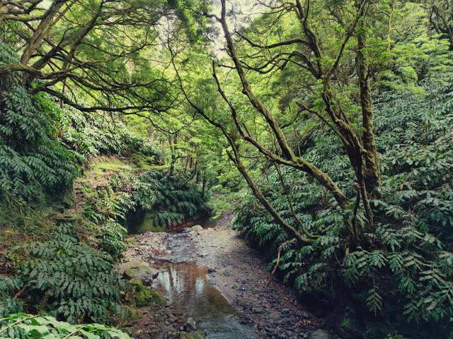
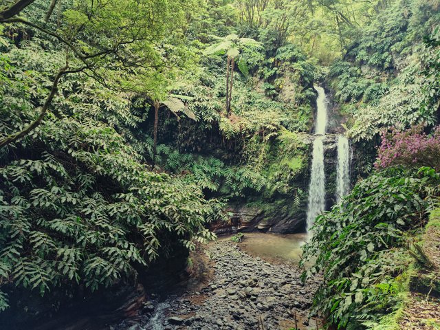
I am sharing photos of landscapes, moments and experiences. Nature and sea are the most visited themes in my photo collection, but any attention-grabbing aspect can be photographed. Hope you enjoy it...
| Category | #italy |
| Location | São Miguel Island - Azores |

)
Congratulations
This post has been curated by
Team #5
@damithudaya
Thanks for stopping by :) I really appreciate the support :) Cheers :)