Exploration-s23w5/Track Signs
How are you all Guys? I hope you are all fine and doing great work. Today I am going to take participate in The exploration challenge that is well organized by @karianaporras. This is very exciting topic for me, so let's start without wasting our time,
 |
|---|
Locate 3 natural trails and 3 artificial trails in your area and explain what each of them is about.
Natural Track
 |
|---|
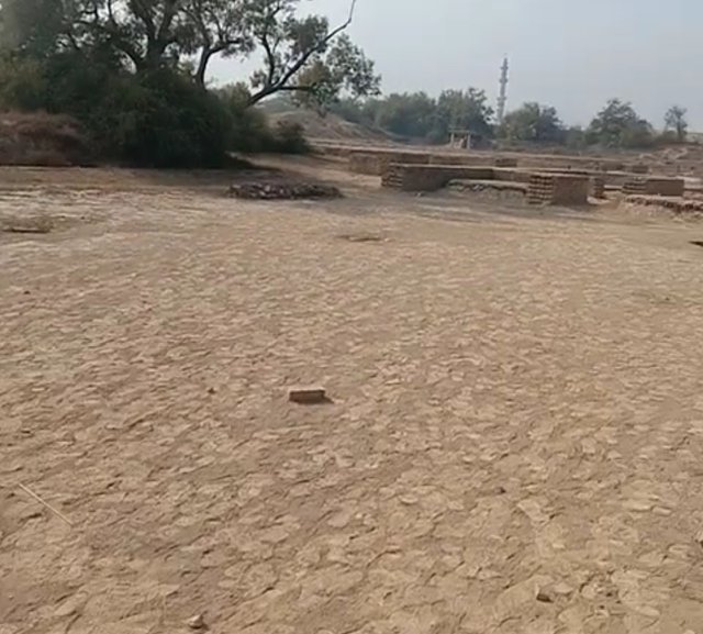
1. This is a natural route that is not made up of concrete or bricks, this has been formed by natural processe such soil and water, as through regular passages of people, animals . The foot prints marks is clear because it's giving signal to us we are following right track and indicating that this pass is still actively used by local communities. The bare floor, dry brown, reflects the simplicity and raw beauty of the country.
This natural path passes through a wide field, which raises the trees on the sides. It is calm, open and refreshing to remember the peaceful connection between humans and nature, with memories of peaceful connections.
 |
|---|
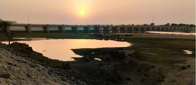
2. This beautiful photo, features a natural tack on the riverbank. This pathway has developed over time due to water flow, animal movement and natural erosion. These types of tracks are not caused by people shaped by nature itself.This is picture is captured by me when I first time went for a interview in other city, I captured this for beautiful view with sunset and also remind as return track
This scene reminds us how nature creates its own paths simple, quiet, and full of life.
 |
|---|
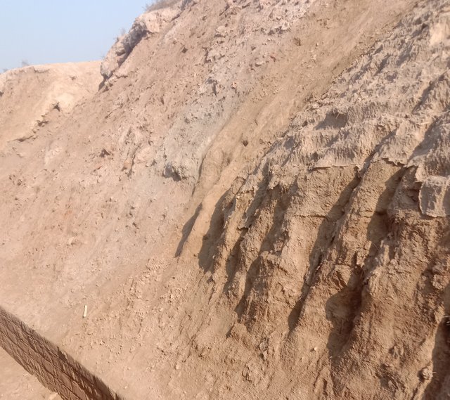
The surface of this given image appears unevenly, with the soil not compressed or evenly created. This indicates that it is not altered or smoothed by human activities typical of natural formation such as erosion and weathering processes. This picture is also captured by me when I went to trip with my friends at harapa city.
There are no visible signs of human structure or intentional adjustment, such as: paving and machinery use.
This contrasts with artificial traces that tend to have solid surfaces made of gravel, concrete, or other artificial materials.
Artificial Track
In today’s modern lifestyle, artificial tracks have become a important part of urban development. When we move away from the natural way, we create artificial routes to ensure relief, accessibility and efficiency in our daily lives.
Let’s take a look at the images:
 |
|---|
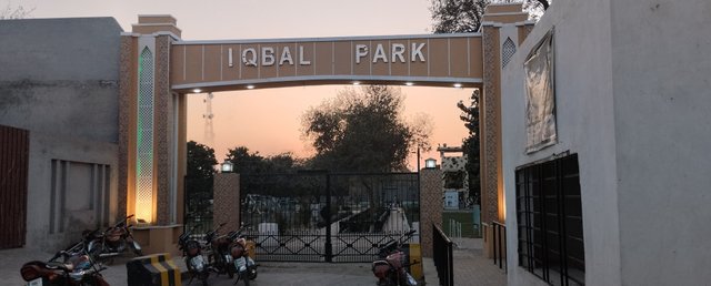
1. Iqbal Park: This park is well constructed artificial walkway leads into the park in my city and about 4 minutes walks away from my home. When we order any thing like food or any item we gave this address because it is famous park in area. Such tracks are now common in parks and public spaces.
 |
|---|
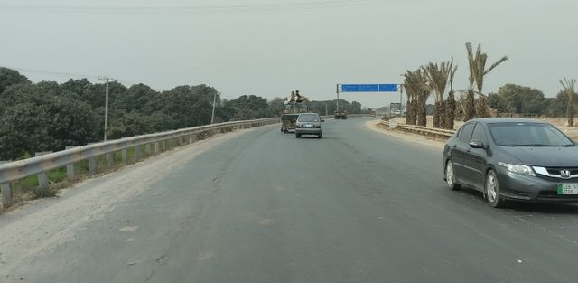
2. Highway & Sign Board: The road and flyover shown in the second image connect cities and make travel quicker and smoother. These artificial tracks are essential for transportation and play a big role in economic development. In this picture we can see that distance board that is inform us how much Kilometers to next city or any place.
 |
|---|
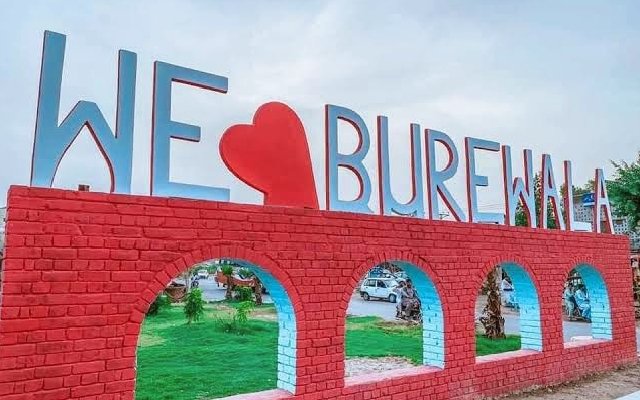
3. "We Love Burewala" Spot: The third image shows a beautifully designed artificial structure in a my city Burewala. This is famous spot in my city and constructed in center of city. This artificial spot enhancing the city's aesthetics and providing a clean space for recreation.
Artificial tracks are not just about concrete and construction, they are about connecting people, ensuring comfort and shaping modern life.
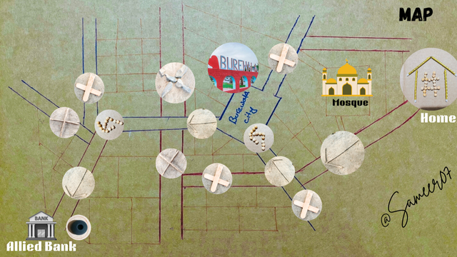
Trace a path in your area and use the clue signs to locate each space on the map accordingly. Remember to use elements of the environment and nature to form the clues
 |
|---|
Explain in your own words the path you followed, the elements you used, and where you arrived.
In upper given map you can see that, I have started my track from home with my brother. As we know teacher informed us to start from the # sign from your location. From the Home, the track moves left, passing the Mosque.
This track continues down and turns left side, weaving through multiple intersections marked by ❌ by placing ice cream woods to mark because we turn right hand side.I place a straight arrow ➡️ using tree wooden sticks, that show we move straight forward to main Chowk of city because when we mostly go market we pass through main Chowk because it's saturated in center of city
After a 5 minute riding the Burewala city chowk was ahead. By following the picture instructions i followed the left-hand side and assigned a trace mark again with straight arrow on this sides. I used a cross sign ❌ indicate the wrong way on right side used wooden stick and small concretes.
After 2 minutes ride from main Chowk, we again to turn left down side that you can see it upper map that I design where I mark ↩️ this arrow and design with legumes because I try to design map with natural things.
Again I add a straight arrow ↖️ to show the correct path using tree sticks, after 3 minutes Ride we reached our destination Allied Bank, where I placed the required signs ▪️at destination position. Our track ended here, at end additionally I add a bank element to enhance our map.
What did you think of this week's homework? Did you know you could leave clues in a very simple way? Was this course easy for you to complete? What was the most difficult part, and what did you learn?
What do you think about this week's homework?
I thought it was surprisingly enjoyable for me! It was able to combine creativity with basic geography and storytelling. I have never imagined how powerful and effective a simple object could be when leaving visual information behind.
Did you know you could leave clues in a very simple way?
Yes, definitely!
I leave clues in a very simple and creative way using just simple materials that Is easily found in nature. In this task, I used sticks, beads, symbols, and colors to represent roads and populated area, turns, and landmarks without any words.
Track I Followed:
I started from the Home symbol # on the right side of the map.
I passed by the Mosque, a key landmark near my area that is added through Canva.
The route went through several intersections marked with symbols like cross ❌, and Arrow ⬆️, created using beads and wooden sticks and stones and ice cream stick.
Then I passed the center of the city, marked by a photo of the Burewala landmark.
Finally, the route led me to the Allied Bank, located at the bottom-left corner of the map.
Materials I Used:
Beads/Pulses to form the shapes of letters and symbols.
Ice cream sticks/wooden sticks and stones are used to mark crossroads or directions.
Images & Icons for major landmarks like the Mosque, Home, Bank, and City Center.
Colored lines, I was used three different colors lines to represent streets and road directions.
Was the course easy to complete?
Overall, it was manageable. But that required planning and a bit of artistic thinking. I had to pay attention to the layout and distance so that everything made sense.
The most difficult part:
The most difficult thing was finding ways to position everything in a visually clear and meaningful way. I wanted everyone looking at the card to understand the pass without the need for lengthy explanations.
What did I learn?
A method of communicating instructions with very basic materials.
The meaning of symbols and how they guide humans.
Simplicity can tell a stronger story than complex designs.
Now this is end of my post, I hope you really like my post. At end I would like invite @faran-nabeel, @suboohi, @munazamalik and @sitaraindaryas, @chant and @mun-eeb to participate in this contest as soon as possible.
Regards,
Abdul Sameer
