Alles bestens! Wanderung um die Saarschleife / Everything perfect! Hike around the Saar loop
english below...
Wir hatten alles, absolut alles im Angebot. Das volle Programm!
Allerfeinstes Wanderwetter, nicht zu heiß, nicht zu frisch. Eine irre schöne Gegend direkt vor der Haustür unserer Gastgeberin – was wir bereits wußten und mit unserer gestrigen Tageswanderung zu vertiefen gedachten. Überraschend wenig Leute in dem so beliebten Wandergebiet. Beste Laune und gefühlt beste körperliche Verfassung…
Darüber hinaus gab es für uns viele Stunden Stecke in zusammenhängendem Waldgebiet – und das fast, ohne einem einzigen Menschen zu begegnen. Picknick unterwegs, geschlossene Ausflugs-Gastronomie… Und Schlangen. Also fast ;-))
Unser Einstieg in die Planung begann mit der Frage an uns selbst, wie viel wir uns zumuten könnten. Da es in der jüngeren Vergangenheit bei uns beiden teilweise kleine Zipperlein gab und wir daher meist ernüchtert von Wanderungen heimkehrten (dieses Älterwerden macht echt unfroh…), trauten wir unserer optimistischen Selbsteinschätzung nicht recht über den Weg. Die Vereinbarung lautete also: ich plane eine 16 Kilometer-Tour in einem Landschaftsprofil mit ca. 450m Höhenunterschied, die mehrmals zu überwinden wären, und falls es einem von uns zu anstrengend wird, kürzen wir spontan ab.
Komoot, meine teils bevorzugte und teils verhaßte Wander-App, sollte wieder unser Begleiter sein. Schon bei der Einrichtung der geplanten Route war ich sehr angenehm überrascht: viele neue Funktionen, viel besseres Handling, tolles neues Layout. Die nervige Stimme ist leider immer noch die altbekannte…
In einen Rucksack kamen ausreichend Getränke für uns beide, belegte Brote, Wiener Würstchen, Bananen und Kleinigkeiten wie Ersatzbrillen. Kleines Gepäck also; etwa 6-7 Stunden Gesamtdauer hatten wir anvisiert.
Wir liefen guter Dinge zum vorgesehenen Startpunkt, der Aussichtsplattform „Cloef“ direkt über der berühmten Saarschleife. Dort machten wir ein paar Beweisfotos von uns im fitten Zustand vor der Unternehmung und starteten die Aufzeichnung in der App.
Sowohl diese als auch die lokalen Beschilderungen gaben uns lediglich den Hinweis, daß die Strecke als schwierig eingestuft ist. Bereits nach wenigen hundert Metern war uns klar: das ist nicht übertrieben. Wir wandern als Amateure auf einem guten Niveau, tragen vernünftiges Schuhwerk und kennen unsere Körper ganz gut. Die meinten sehr schnell: ‚Aber hallo!‘ Ich erlebte die Strecke, die wir letztendlich zurücklegten, durchgängig als fast naturbelassen. Wir fanden keine nennenswerten Befestigungen oder Sicherheitseinrichtungen, keine Warnschilder. Es war für deutsche Verhältnisse unwirklich, wie viel Eigenverantwortung dem Wanderer hier zugestanden wird. Erinnerte mich sehr angenehm an Wandergebiete in Österreich und Frankreich. Neben meiner Begeisterung nahm ich natürlich zur Kenntnis, daß in lockerer Regelmäßigkeit Notrufpunkte mit genauen Geodaten im Wald verteilt waren – das Bergrettungssystem scheint nicht ohne Grund gut ausgebaut zu sein…
Auf Verletzungen und andere Pannen wollten wir weitgehend verzichten und achteten gut auf Steinschläge, Geröll und morsche Bäume.
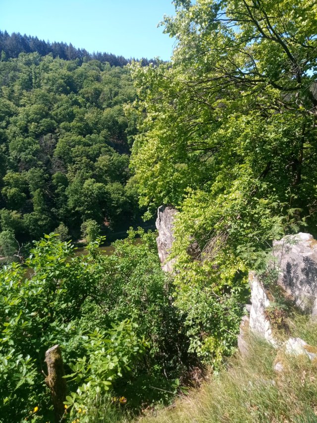
Derer gab es so einige; das Waldgebiet wird weitgehend sich selbst überlassen, es bildet sich neues Unterholz über Totholz und die Waldentwicklung sieht nachhaltig aus, weil sie eben nicht vom Menschen forciert wird.
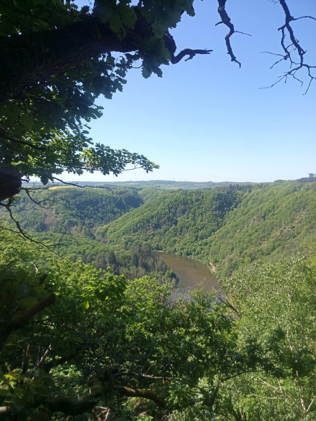
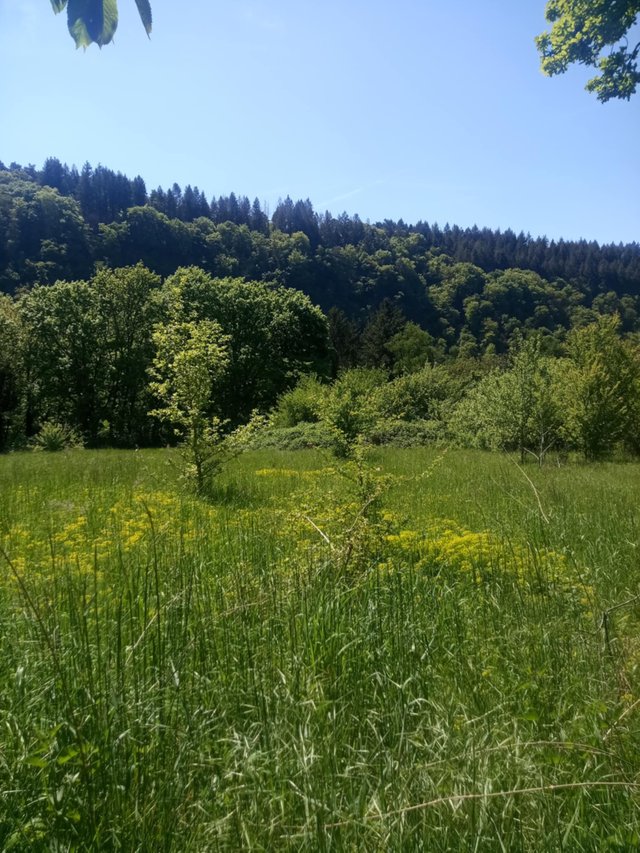
Die optischen Eindrücke sind phänomenal, es riecht harzig und frisch, man kann den Wald an jeder Stelle einatmen. Das Grün ist üppig und mehrheitlich gesund; an einigen Stellen sind kranke und abgestorbene Lärchen Deckung und Schutz für junge Schößlinge.
Überall, wirklich überall, lagen Eidechsen und Blindschleichen in der Sonne. Nun sind letztere keine lebensgefährlichen Würgeschlangen, wie @sbamsoneu sie argwöhnte. Genau genommen ja überhaupt keine Schlangen, sondern ebenfalls Eidechsen, die evolutionsbedingt keine Beine mehr haben. Sie sehen aus wie Schlangen, bewegen sich wie Schlangen… Tada! Schlangen ;-))) Die gezeigte war etwa 40cm lang und schlängelte elegant von dannen, als wir uns näherten…
Man sagt, daß die Umwelt in Ordnung ist, wo sich Schlangen und Eidechsen wohl fühlen: wenn das ein zuverlässiger Indikator ist, gibt es um die Saarschleife herum keinen Grund zu klagen.
Und wir liefen und liefen. Wie die Duracell-Häschen liefen wir immer weiter. Picknick zwischendurch an malerischen Aussichtspunkten. Endloser vielfältiger Wald, Vogelstimmen und dezente Sonne… Ich kann verraten, daß wir in 7 Stunden (so lange wurde die Tour am Ende) genau zwei Wanderer trafen und zwei Radfahrer auf einer Fähre, die wir für eine kurze Etappe nutzen mußten, um über die Saar zu kommen.
Es war himmlisch!
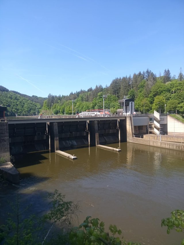
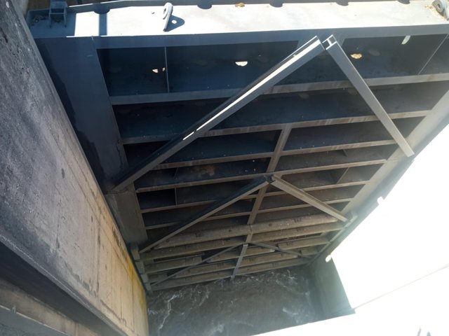
Auf einem Teilstück entlang des Saarufers passierten wir eine Staustufe mit Schleuse. Wir konnten die Absenkung eines nicht ganz kleinen Ausflugsschiffes anschauen.
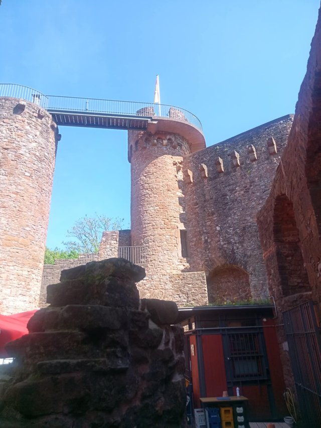
Wir fühlten uns mit jedem Schritt wohler. Auf einer Burg am Weg, Montclair, ließen wir es uns nicht nehmen, alle Stufen bis hinauf auf den Wehrgang zu klettern. Grandioser Ausblick über die ganze Region! Leider war die Gaststätte im Burghof geschlossen – wir vermuten, es gibt, wie auch an vielen anderen Stellen spürbar, ein Personalproblem.
Von dort wieder begab Richtung Fähranleger ging es eine Weile sehr zügig, sind immer noch fit, die beiden alten Herrschaften ;-)) Auf der winzigen, aber superschnellen Fähre sahen wir die Saar noch einmal aus ganz anderer Perspektive.
Wenige hundert Meter nach dem Ausstieg am anderen Ufer verendete mein Handy; die schöne neue Funktionalität der Komoot App kostet unglaublich viel Akkukpazität (ich habe nun schon ein Outdoorgerät mit riesigem Akku! Denkste…) An der Stelle brach also auch die Aufzeichnung unserer Tour ab, aber ich sah beim Verschwinden der letzten Anzeige unseren aktuellen Kilometerstand: 21,7 Kilometer! Ich schätzte, daß noch etwa 3,5 Kilometer bergauf vor uns lagen, bis wir wieder am Ausgangspunkt ankämen. Und auch die rockten wir! Gegen Ende merklich müde und erschöpft, aber ich versichere Euch: glücklich!
Eventuellen Nachahmern rate ich zu festen Schuhen, ausreichend Proviant und einer guten Trittsicherheit. Kondition und Beweglichkeit sollten nicht beeinträchtigt sein. Hunde sind überall willkommen.
So einen schönen runden und aktiven Wohlfühltag hatten wir lange nicht mehr. Wir wurden mit Marmorkuchen und Mehlknäppsche (ein traditionelles saarländisches Gericht aus Kartoffeln, Mehlklößchen und Speck-Sahne-Soße…) empfangen und konnten den Rest des Tages im Liegestuhl auf der Terrasse ausklingen lassen, Rotwein inklusive…
english version:
We had everything, absolutely everything on offer. The full programme!
The very best hiking weather, not too hot, not too fresh. An incredibly beautiful area right on the doorstep of our hostess - which we already knew and intended to explore further on yesterday's day hike. Surprisingly few people in this popular hiking area. We were in a great mood and felt in the best physical condition...
What's more, we spent many hours walking in contiguous woodland - almost without meeting a single person. Picnics along the way, closed catering outings... And snakes. Well, almost ;-))
We started our planning by asking ourselves how much we could take on. As we'd both had a few minor ailments in the recent past and therefore usually returned home disillusioned from hikes (this ageing really makes one unhappy...), we didn't really trust our optimistic self-assessment. So the agreement was: I would plan a 16 kilometre tour in a landscape profile with a difference in altitude of around 450m, which would have to be overcome several times, and if one of us found it too strenuous, we would spontaneously cut it short.
Komoot, my partly favourite and partly hated hiking app, was to be our companion again. I was very pleasantly surprised as soon as I set up the planned route: lots of new functions, much better handling, great new layout. Unfortunately, the annoying voice is still the same as before...
One rucksack contained enough drinks for both of us, sandwiches, sausages, bananas and small items such as replacement glasses. A small pack, in other words; we had planned a total time of around 6-7 hours.
We walked in good spirits to the designated starting point, the ‘Cloef’ viewing platform directly above the famous Saar loop. There we took a few proof photos of ourselves in a fit state before the undertaking and started the recording in the app.
Both these and the local signposts simply told us that the route was classed as difficult. After just a few hundred metres, we realised that this was no exaggeration. As amateurs, we hike at a good level, wear proper footwear and know our bodies quite well. They very quickly said: ‘But hello!' I found the route we ended up travelling to be almost completely unspoilt. We didn't find any significant fortifications or safety equipment, no warning signs. By German standards, it was unreal how much personal responsibility is granted to hikers here. It reminded me very pleasantly of hiking areas in Austria and France. In addition to my enthusiasm, I naturally noticed that emergency call points with precise geodata were dotted around the forest at regular intervals - the mountain rescue system seems to be well developed for a reason...
We wanted to avoid injuries and other mishaps as far as possible and paid close attention to falling rocks, scree and rotten trees.
There were quite a few of these; the forest area is largely left to its own devices, new undergrowth forms over dead wood and the forest development looks sustainable because it is not forced by humans.
The visual impressions are phenomenal, it smells resinous and fresh, you can breathe in the forest at every turn. The greenery is lush and mostly healthy; in some places, diseased and dead larch trees provide cover and protection for young saplings.
Everywhere, really everywhere, lizards and slow worms lay in the sun. Now the latter are not life-threatening constrictors, as @sbamsoneu suspected. Strictly speaking, they are not snakes at all, but also lizards, which have no legs due to evolution. They look like snakes, move like snakes... Tada! Snakes ;-))) The one shown was about 40cm long and slithered elegantly away as we approached...
It is said that the environment is fine where snakes and lizards feel at home: if this is a reliable indicator, there is no reason to complain around the Saarschleife.
And we walked and walked. Like Duracell bunnies, we ran and ran. Picnics in between at picturesque viewpoints. Endless varied forest, birdsong and subtle sunshine... I can reveal that in 7 hours (that's how long the tour ended up being) we met exactly two hikers and two cyclists on a ferry that we had to use for a short stage to get across the Saar.
It was heavenly!
On a section along the banks of the Saar we passed a barrage with a floodgate. We were able to see the lowering of a not-so-small excursion boat.
We felt more comfortable with every step. At a castle along the way, Montclair, we didn't miss the opportunity to climb all the steps up to the battlements. Magnificent views over the whole region! Unfortunately, the restaurant in the castle courtyard was closed - we suspect there is a staffing problem, as is noticeable in many other places.
From there, we made our way back to the ferry terminal at a very brisk pace for a while - the two old folks are still fit ;-)) On the tiny but super-fast ferry, we saw the Saar from a completely different perspective.
A few hundred metres after getting off on the other bank, my mobile phone died; the Komoot app's lovely new functionality costs an incredible amount of battery power (I already have an outdoor device with a huge battery! Think again...) So the recording of our tour also stopped at this point, but I saw our current mileage when the last display disappeared: 21.7 kilometres! I estimated that we still had about 3.5 kilometres uphill to go before we got back to the starting point. And we rocked that too! Towards the end we were noticeably tired and exhausted, but I can assure you: happy!
I would advise potential imitators to wear sturdy shoes, have sufficient refreshments and be sure-footed. Fitness and mobility should not be impaired. Dogs are welcome everywhere.
It's been a long time since we've had such a lovely, well-rounded and active feel-good day. We were welcomed with marble cake and Mehlknäppsche (a traditional Saarland dish made from potatoes, flour dumplings and bacon and cream sauce...) and were able to round off the rest of the day in a deckchair on the terrace, red wine included...
.jpeg)
.jpeg)
.jpeg)
.jpeg)
.jpg)
.jpeg)
.jpeg)
.jpeg)
.jpeg)
.jpeg)
.jpeg)
.png)
That sounds like a wonderful way to spend the day. If I wasn't on childcare duties, I'd be up on the South Downs this instant!
And like you say, that's not a snake... definitely too small too 😉
Do you tag your walks on steem atlas? This looks like the perfect content to add in my opinion.
Yes, I will collect some trips again and pin them on Steem Atlas.
I'm loving the image... there's a hint of @disconnect to it.
Once a MOuSE always a mouse I guess 😎
@ wakeupkitty checking replies wishing you a relaxed day
🍀♥️
Puh, da hattet ihr ja ein ordentliches Programm. 21 km sind schon eine sehr gute Strecke und das in 3 Stunden! Hut ab! Andere Schuhe hätte ich dir/euch jetzt aber wirklich empfohlen :-)
Wir haben in diesem Jahr auch wieder eine Wandung in den Alpen vor. Im Juni wird es soweit sein. Freue mich schon sehr! Das ist doch mal eine ganz andere Landschaft als das, was wir sonst so täglich vor der Tür haben.
Cool! Da war ich schon länger nicht mehr...
Hehe - nix gegen die Schühchen. Ty-ty steht auf so maßangefertigte und handgenähte mit super Profil und festem Schaft. Und fährt echt gut damit. Für mich müssen sie superleicht, superweich und superangenehm am Fuß sein. Dann geht zwischendrin auch mal Klettern.
Auf die Strecke sind wir schon recht stolz, wollen jetzt lansam wieder aufbauen und die Kondition ein paar Jahre zurückdrehen ;-))
🍀♥️
You see why I will find it difficult to do such hikes… you guys were able to see this one’s because it was in an open place, what about those that were hiding in the grasses. Is too risky!
For a new place you guys are entering for the first time, I was expecting there will be guide directing you guys in the bush path?
Not at all. You can't really imagine the dimensions here; you have an overview through the mountain ranges and can always orientate yourself. There have certainly been people who have lost their way in the woods, but even then a hiking map or Google Maps can quickly help you get back on track. The kind of danger you have in mind doesn't exist here. And the same things lurk in the grass that lurk along the path... Only more of it ;-))
Hello, how are you? Your great adventure is delicious, beautiful, and long. I hope to visit those places someday. Greetings.